Cityweft at AEC Tech+ Barcelona: Real-World Context in Minutes
Earlier this summer, Cityweft partnered with the AEC Tech+ Hackathon in Barcelona, hosted by CORE studio at Thornton Tomasetti, McNeel Europe, and BIG - Bjarke Ingels Group. Over the weekend participants from Architecture, Engineering, and Construction backgrounds set out to explore how new tools and workflows could transform design and analysis in the built environment. As a partner of the event, we opened our API to all teams to provide them instant access to high-quality, real-world 3D context.
One of those teams, no-code-nodes, went on to win Best Overall Hack. Their success highlighted exactly what we’ve built Cityweft for: a powerful dataset, delivered through an API that can be integrated quickly and used immediately.
“The data ‘mining’ issue”
For most architects, early-stage design begins with data hunting: chasing information scattered across multiple sources, often in outdated or incomplete formats. According to Karim Daw, Data Engineering Leader at Gensler and member of the winning team, this is one of the biggest time sinks in any project:
“Cityweft solves the site data 'mining' issue that occurs on every project: that the required data is in disparate, and often disorganized and outdated, formats and digital locations. Finding and organizing this data usually takes a huge amount of time and is often unrecognized (and unpaid) work for architecture firms.”
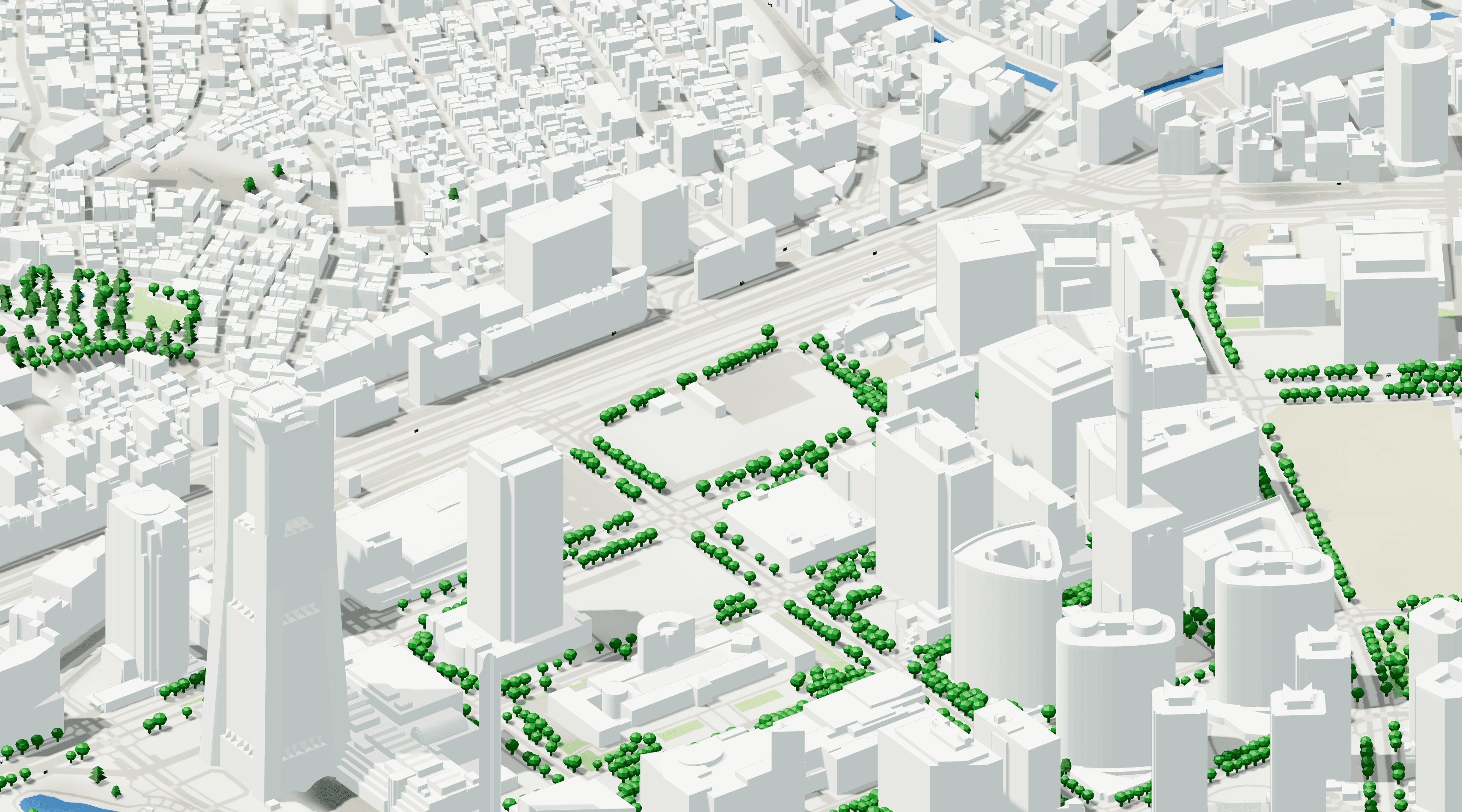
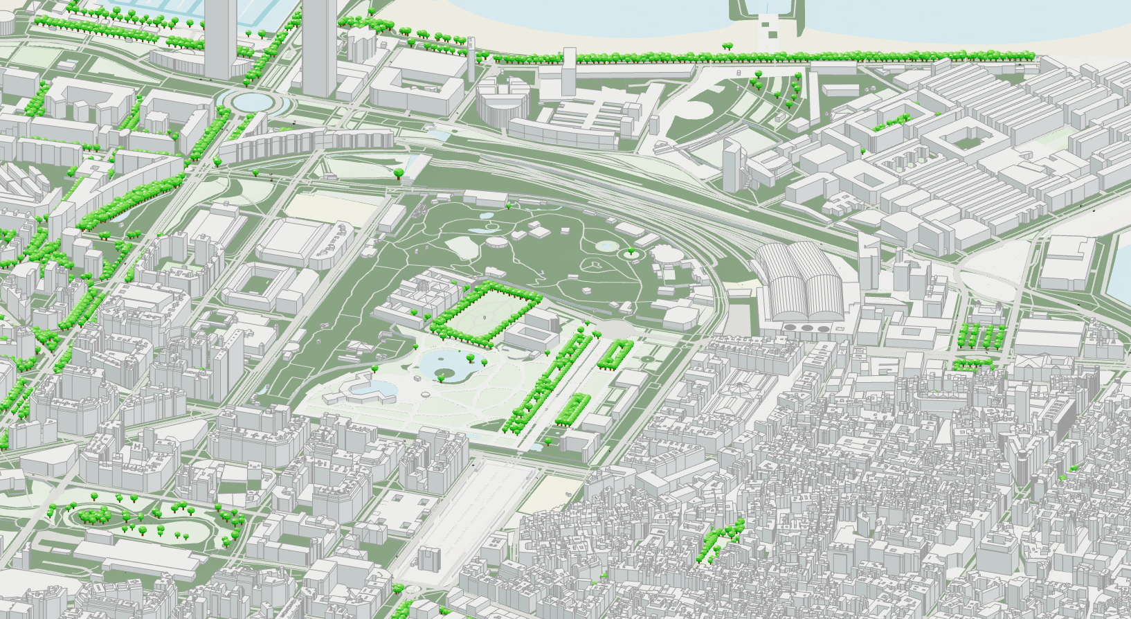
Cityweft eliminates that step by delivering detailed, structured 3D city data through a simple API call.
“Cityweft provides data which is extremely detailed, broken down by 3D buildings, plot data, infrastructure, even down to the types of trees and local landmarks! The data structure they use will be familiar to any team accustomed to handling 3D data.”
What the Team Built
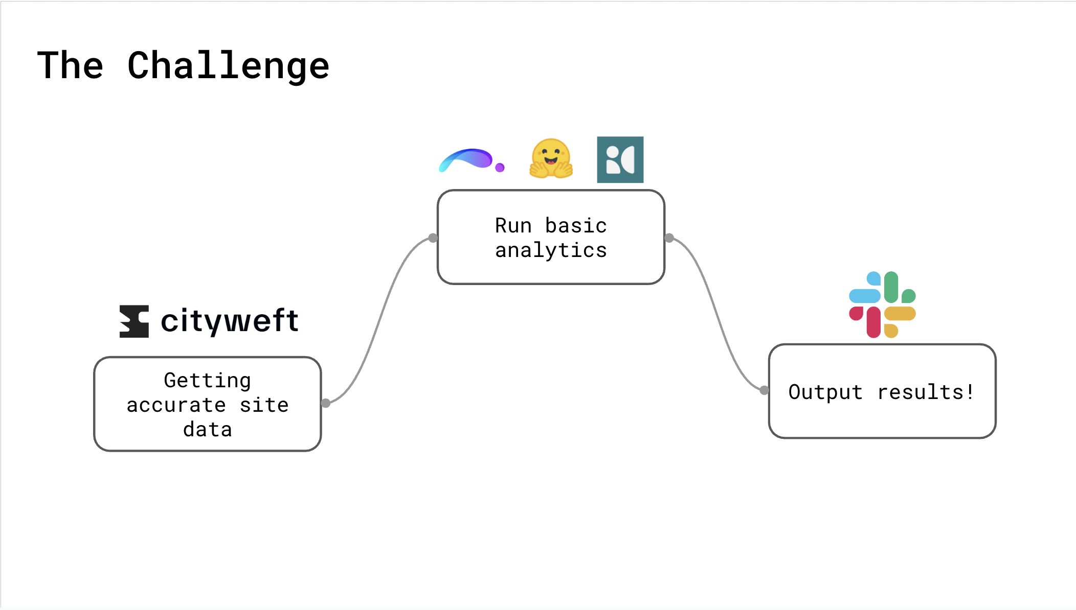
With Cityweft as their data backbone, the no-code-nodes team used n8n to stitch together a full pipeline in just two days:
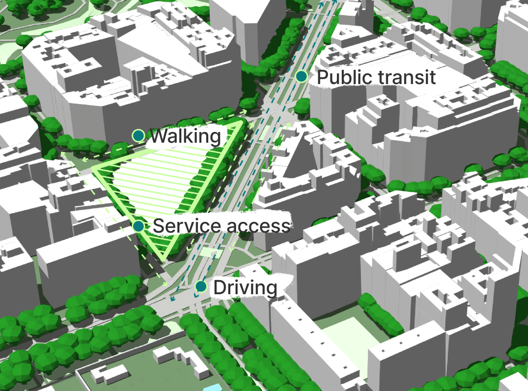
Cityweft API → Supplied buildings, parcels, and contextual 3D geometry
ShapeDiver + Grasshopper → Ran parametric site analyses remotely
OpenAI → Classified and interpreted metadata from Cityweft
infrared.city → (partially prototyped) for environmental simulation
Slack → Delivered automated reports to the user
They even wrote custom JavaScript functions to aggregate building and surface stats and a simple wrapper to bring Cityweft geometry into Grasshopper - all within the hackathon timeframe.
The result: a one-click browser tool that could transform any location into meaningful site insights.
“For more technical teams, Cityweft's API was very easy to use; it has a simple endpoint with an understandable response payload. I found the metadata component particularly interesting as I could easily glean useful metrics pertaining to the retrieved 3D assets.”
Traceable, Reliable Data
Another advantage for the team was Cityweft’s data transparency. Unlike many providers who rely on a single geospatial source, Cityweft aggregates and processes data from multiple inputs.
“The fact that Cityweft does not rely on one sole geospatial data provider but has built a solution that ingests and processes data from myriad sources is a key selling point for me. The data they provide is easily traceable and auditable.”
Why This Matters
What stood out during the hackathon was how fast Cityweft could be integrated. In the short 24-hour Hackathon, the no-code-nodes team had 3D context powering a prototype that went on to win Best Hack.
As Karim reflected:
“When I began my career 15 years ago I would have been extremely grateful for the time and effort Cityweft would have saved me on projects. I love it when I come across a solution that in retrospect feels so obvious. I will definitely recommend their platform to any professional needing a one-stop solution for all their 3D contextual data.”

Celebrating Innovation
As recognition for their achievement, the no-code-nodes team received free access to Cityweft’s API for the rest of the year. Their success showed what we believe strongly: when data is instantly available, innovation happens faster.
At Cityweft, our mission is to make high-quality, structured 3D city data accessible in minutes - so that architects, urban planners, and AEC developers can focus on building ideas, not searching for data.
Try the Cityweft API
If you’re developing your own tools or workflows, Cityweft can give you the same boost the no-code-nodes team experienced: valuable data, easy integration, and real results - fast.
👉 Learn more about the Cityweft API and see how real-world context can power your next project.