Cityweft Expands Free Access to High-Quality 3D City Models
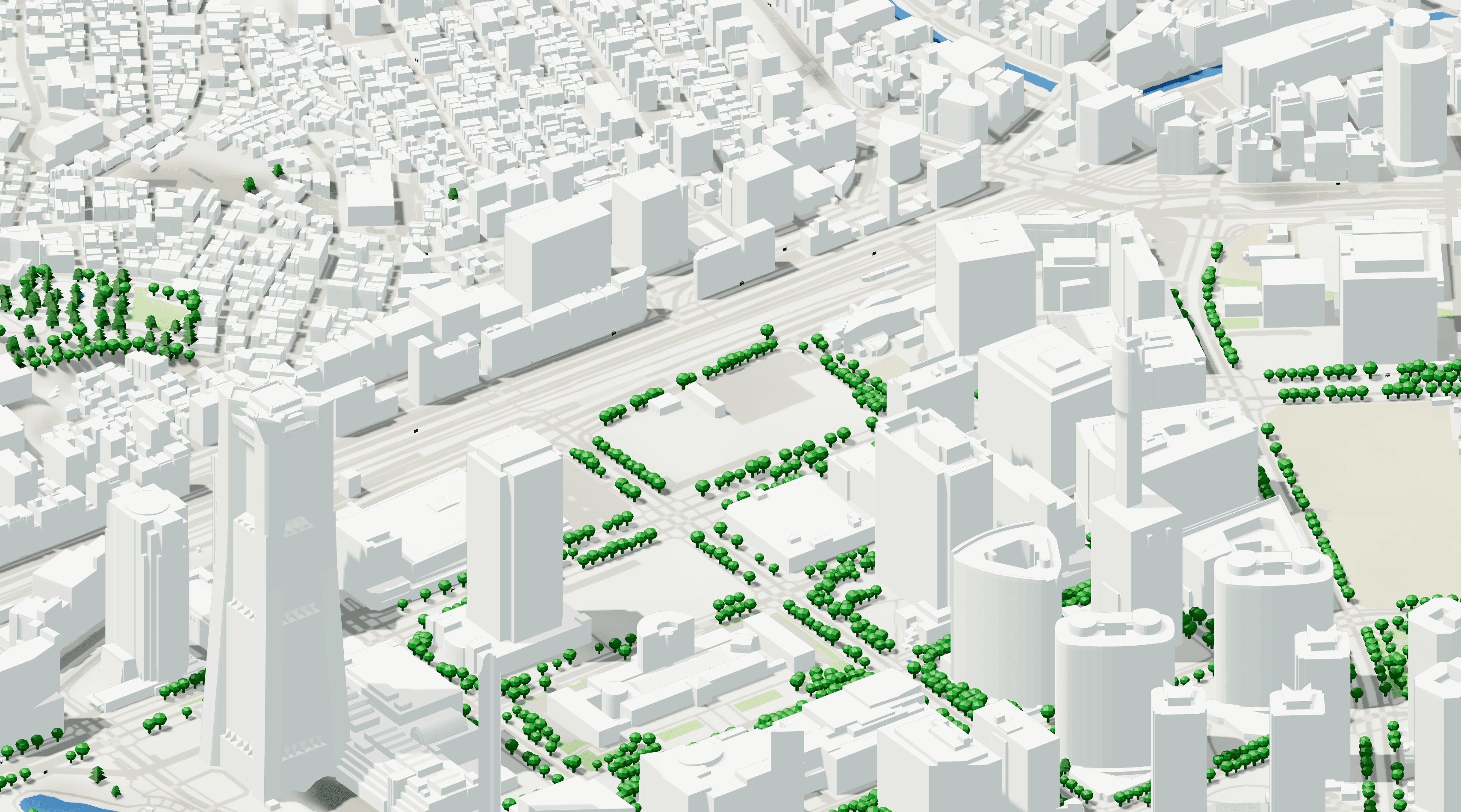
Over the past few months, the Cityweft platform has been growing at full speed. Since launch, we’ve integrated over 100 global data sources — spanning topography, surface mapping, building geometry, and more — to give architects, planners, and designers a fast, reliable way to access geospatial context.
Now, we’re making it even easier to get started. To help more architects, planners, and students leverage Cityweft, we’re expanding our free offering so anyone can begin creating 3D city models without a subscription.
What’s Changing
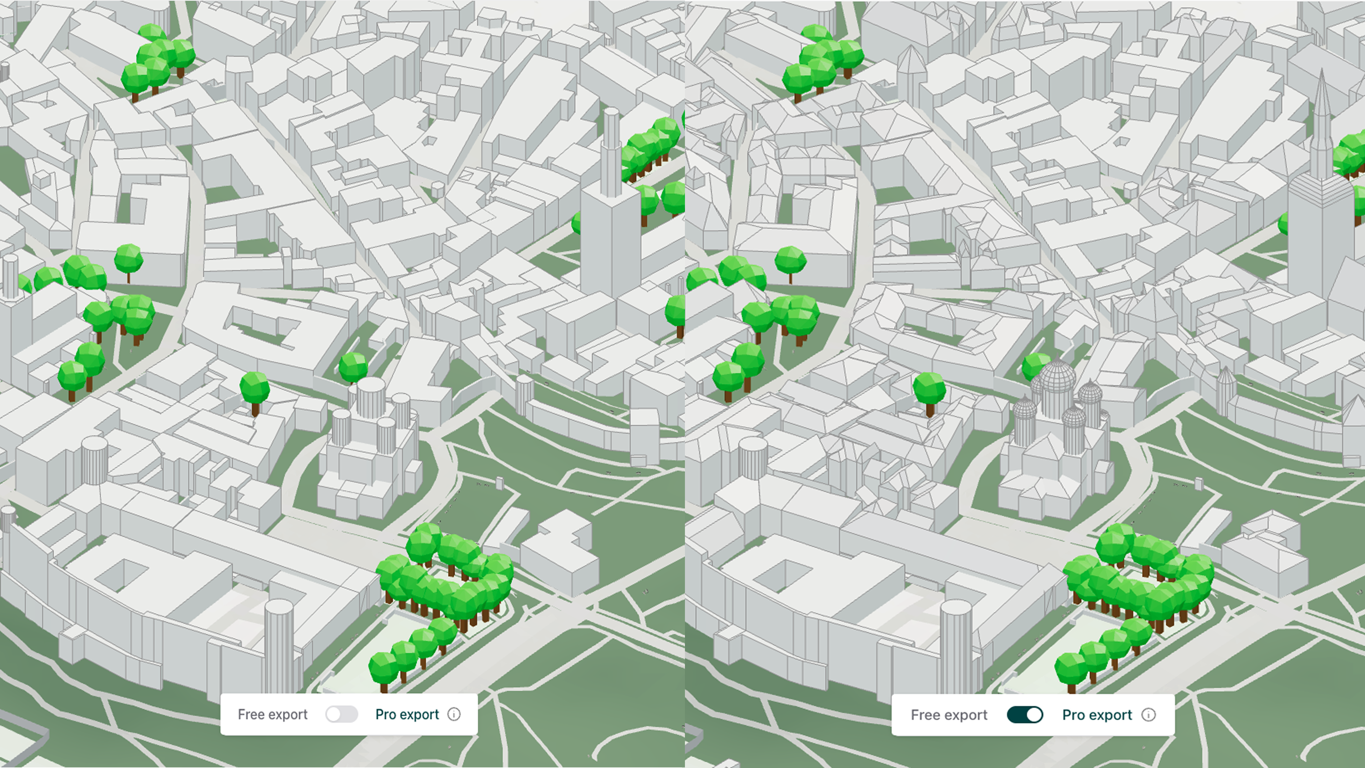
Starting today, Cityweft users can export up to 1km2 for free including:
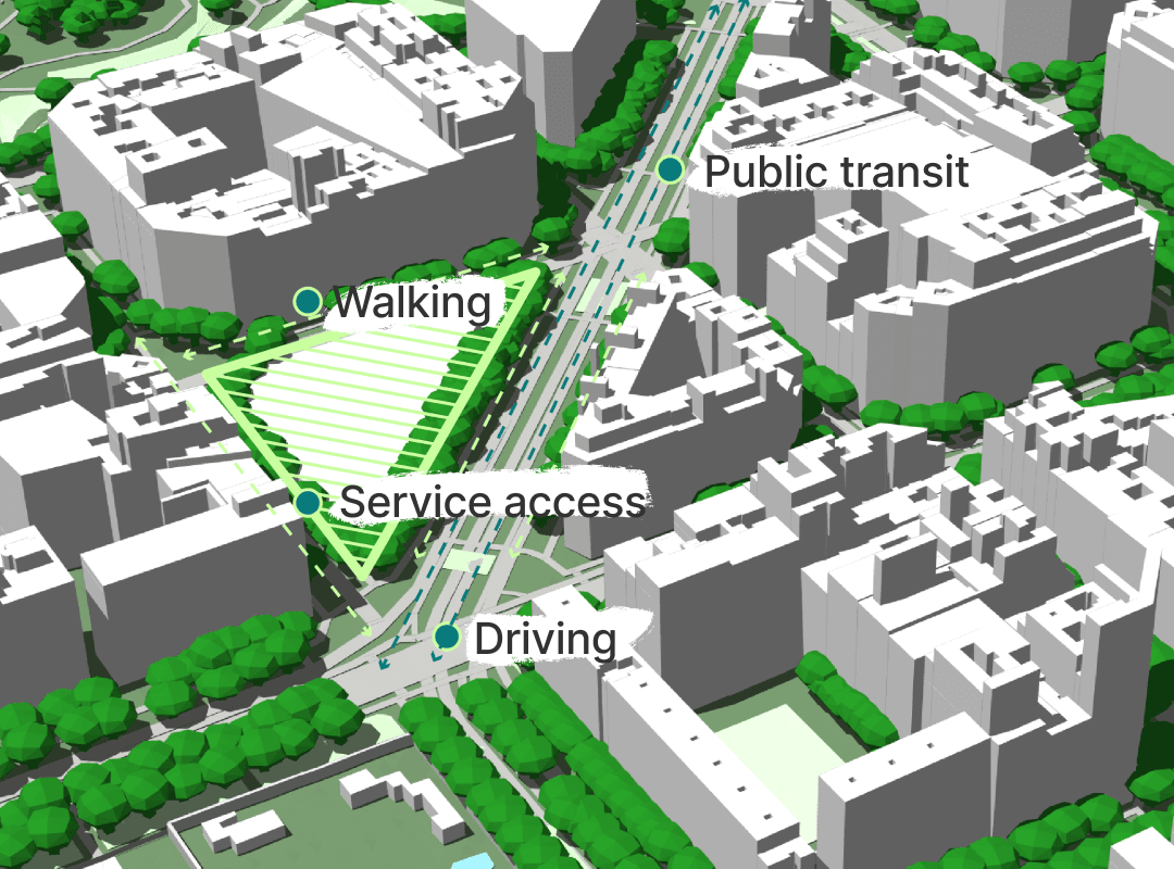
Global topography data (~30 m resolution), simple 3D buildings, surface mapping, barriers, and instances (e.g. trees, public transport, cranes)
Data from OpenStreetMaps, USGS and NASA datasets
Full export options supporting Rhino, Sketchup, Revit, Unreal Engine, Blender, and more
These updates mean that anyone - from students to professionals - can instantly get access to a clean, ready-to-use 3D model from around the world.
Where most free tools provide incomplete, messy, or hard-to-use datasets, Cityweft delivers a fully processed model that’s compatible with your preferred 3D design software right out of the box.
In short: the barrier to exploring, testing, and designing in 3D city context has never been lower.
Ready to take things further?
While the free tier is a great starting point, Cityweft’s paid plans unlock the full precision and coverage that professionals need for detailed design work.
With a paid subscription, you get:
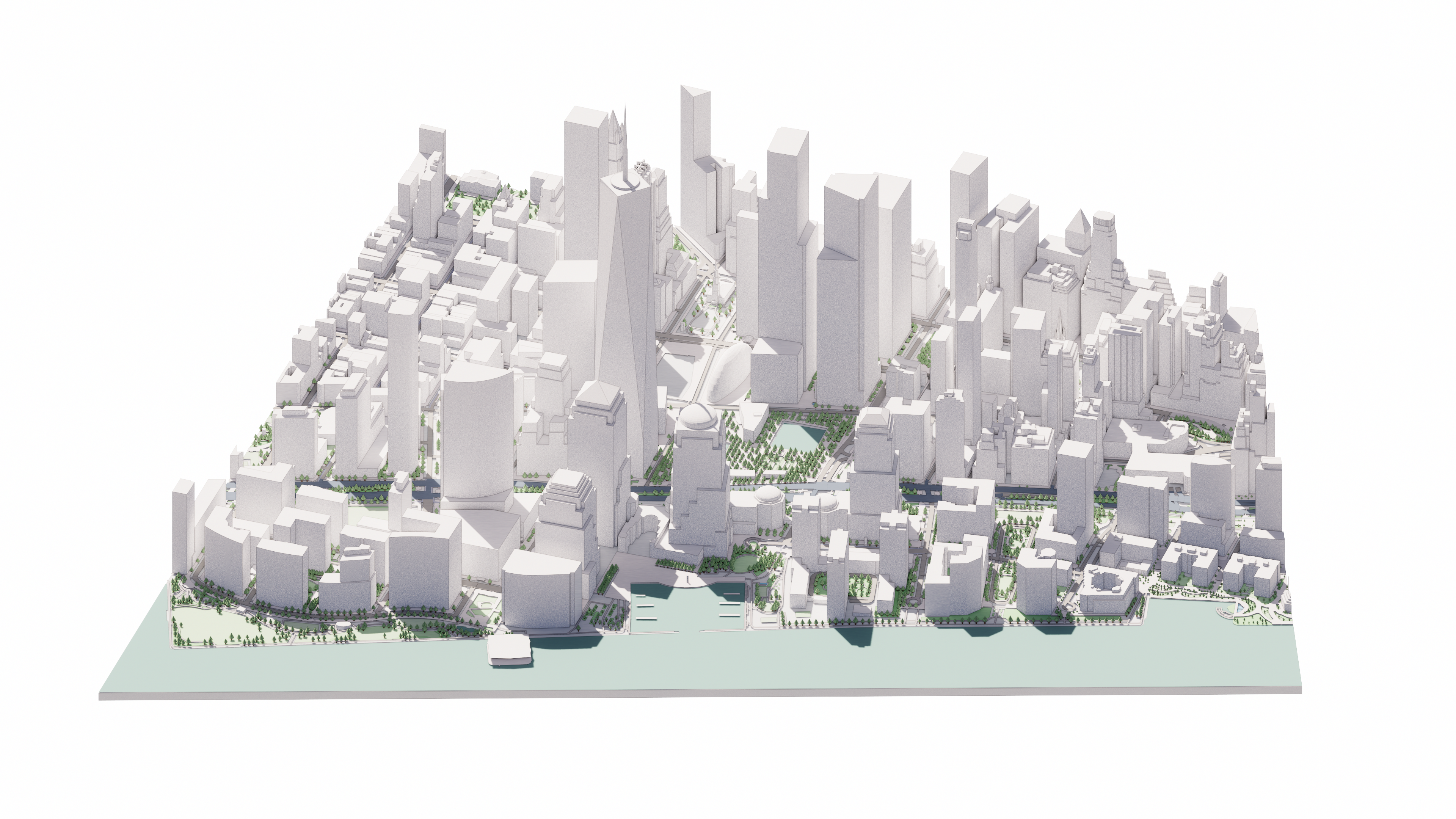
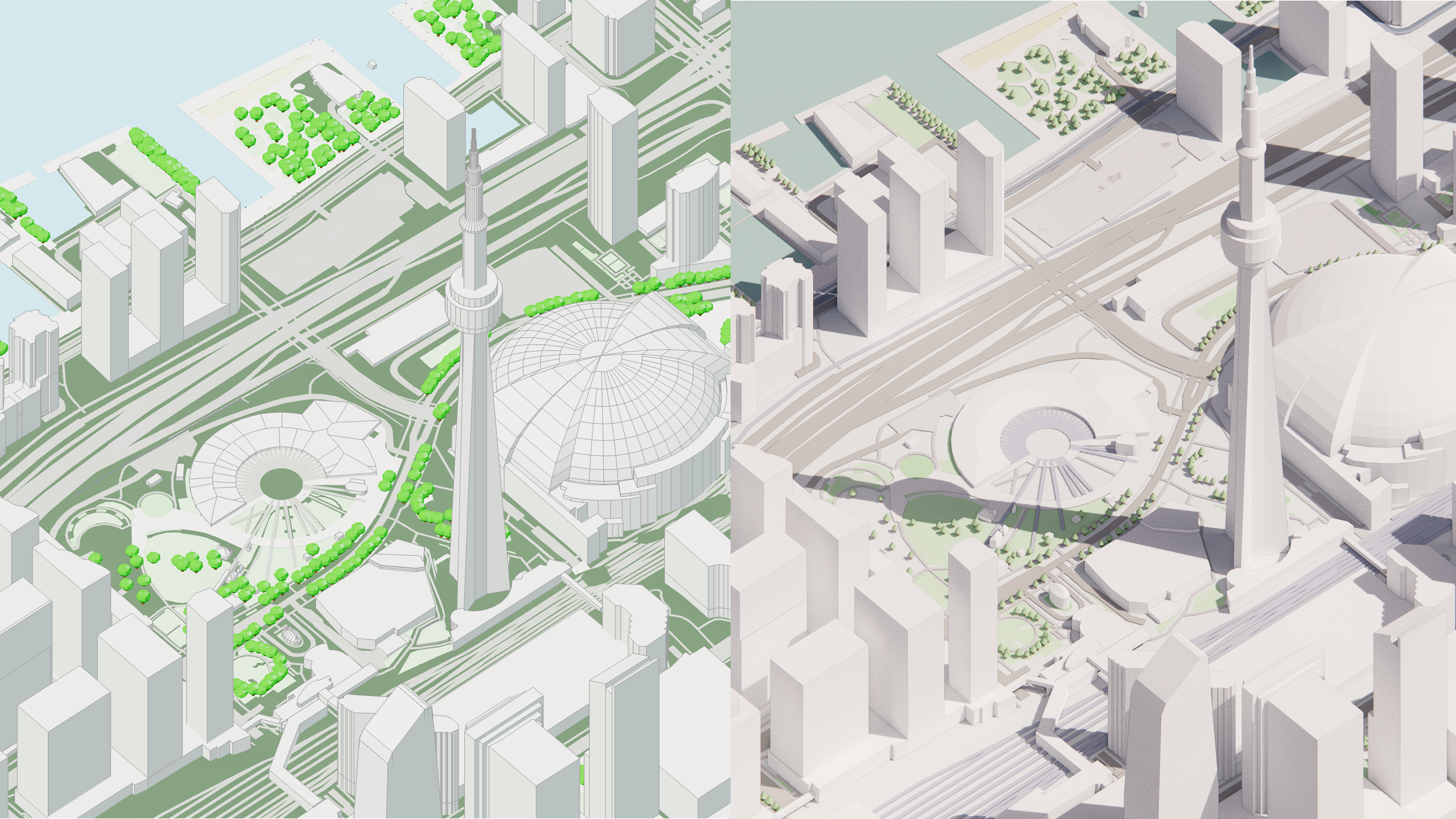
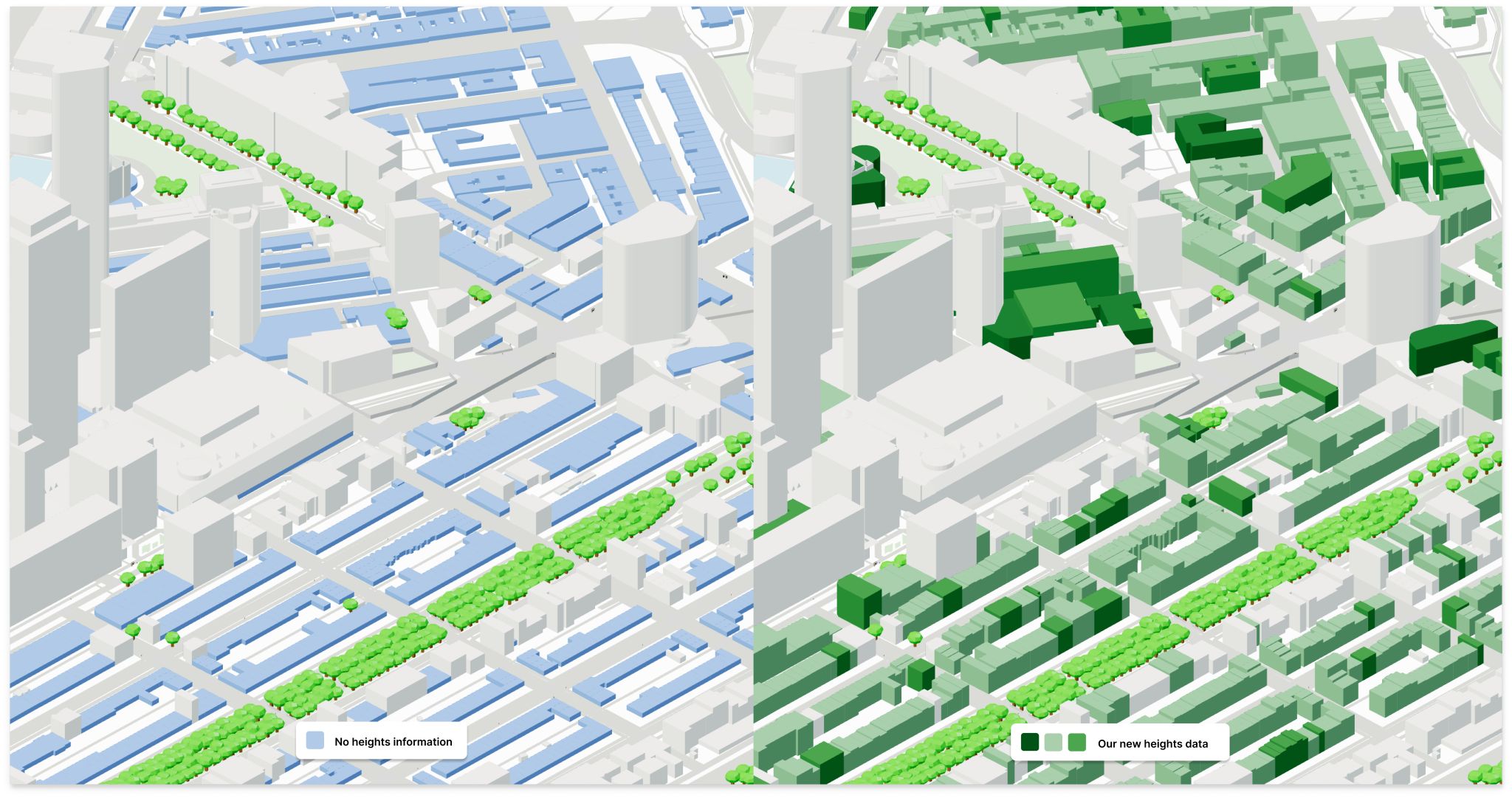
Detailed building geometry, including 12 different roof shapes
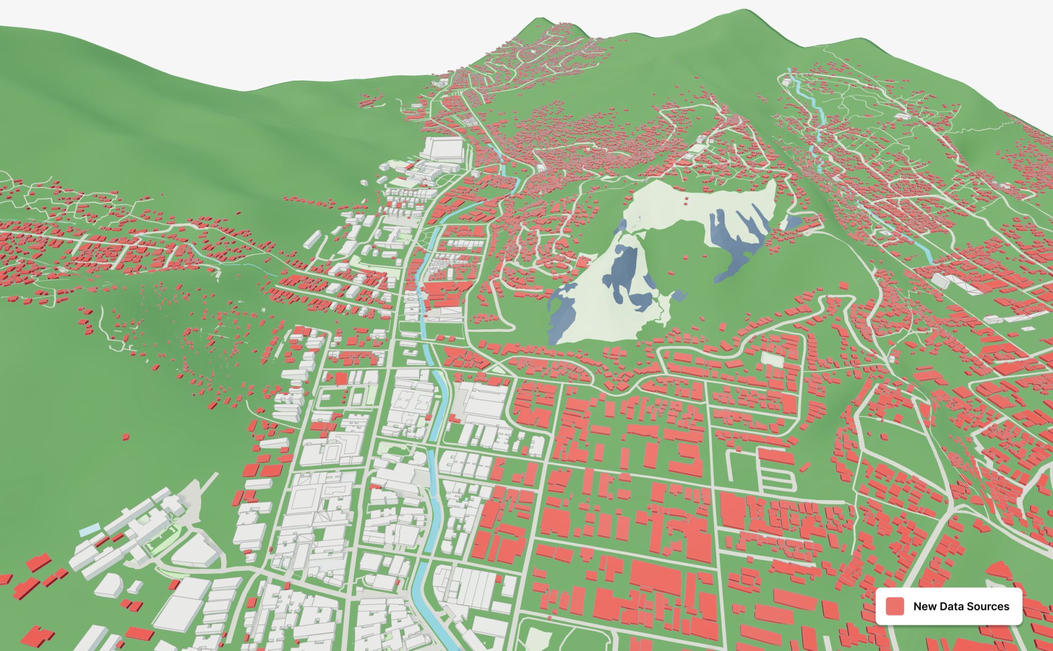
Richer building datasets: roughly 2 billion additional global building footprints (compared to about 650 million from OpenStreetMap) and over 300 million additional building height data points across Europe and North America. These come from sources like Microsoft Building Footprints, Google Buildings, Esri, and USGS LiDAR (where available).
High-resolution topography: access to dozens of local datasets from countries and municipalities worldwide, with resolutions down to less than 1m, enabling highly accurate grading, terrain modelling, and flood or slope analysis.
Larger export areas: generate models for entire districts, cities, or regions in one go, without stitching smaller exports together.
For professionals, this means more accurate models, faster iterations, and reliable context data you can trust from concept through to delivery.
What’s to Come
This update is just the first step. We’re already working on features and data expansions that will take Cityweft even further.
More Data: We’re expanding our data coverage with more localized datasets from around the world, starting with Europe. These datasets bring higher accuracy, richer details, and more reliable coverage for buildings, terrain, and other geospatial layers. We’re also adding more interoperability options, so your models fit seamlessly into the tools and platforms you already use.
More Exports: We’re working to increase export limits so you can work with larger areas at once, making it easier to model entire neighborhoods, districts, or cities without breaking your workflow into smaller chunks.
These upcoming improvements will keep building on our mission: to make high-quality, ready-to-use 3D city models available to anyone who needs them, anywhere in the world.
How to Get Started
The best way to understand Cityweft is to see it in action.
Explore the world in 3D, test your ideas, and bring your designs to life - starting today.
Visit app.cityweft.com to try our free version and experience just how easy it is to turn complex geospatial data into clean, ready-to-use models.
If you’re ready to go further - with higher precision, richer datasets, and the power to model entire cities - we’d love to talk.
Reach out at contact@cityweft.com and let’s explore how Cityweft can become part of your creative toolkit.