Cityweft vs. OSM-Based 3D Models
Looking for an alternative to OSM-based 3D city models? Cityweft is built for architects who need complete, exportable 3D site context—with building heights, roofs, terrain, and richer datasets than OpenStreetMap alone. It’s the fastest way to go from open data to a usable 3D city model for design.
Try Cityweft →
From Open Data to Complete City Context
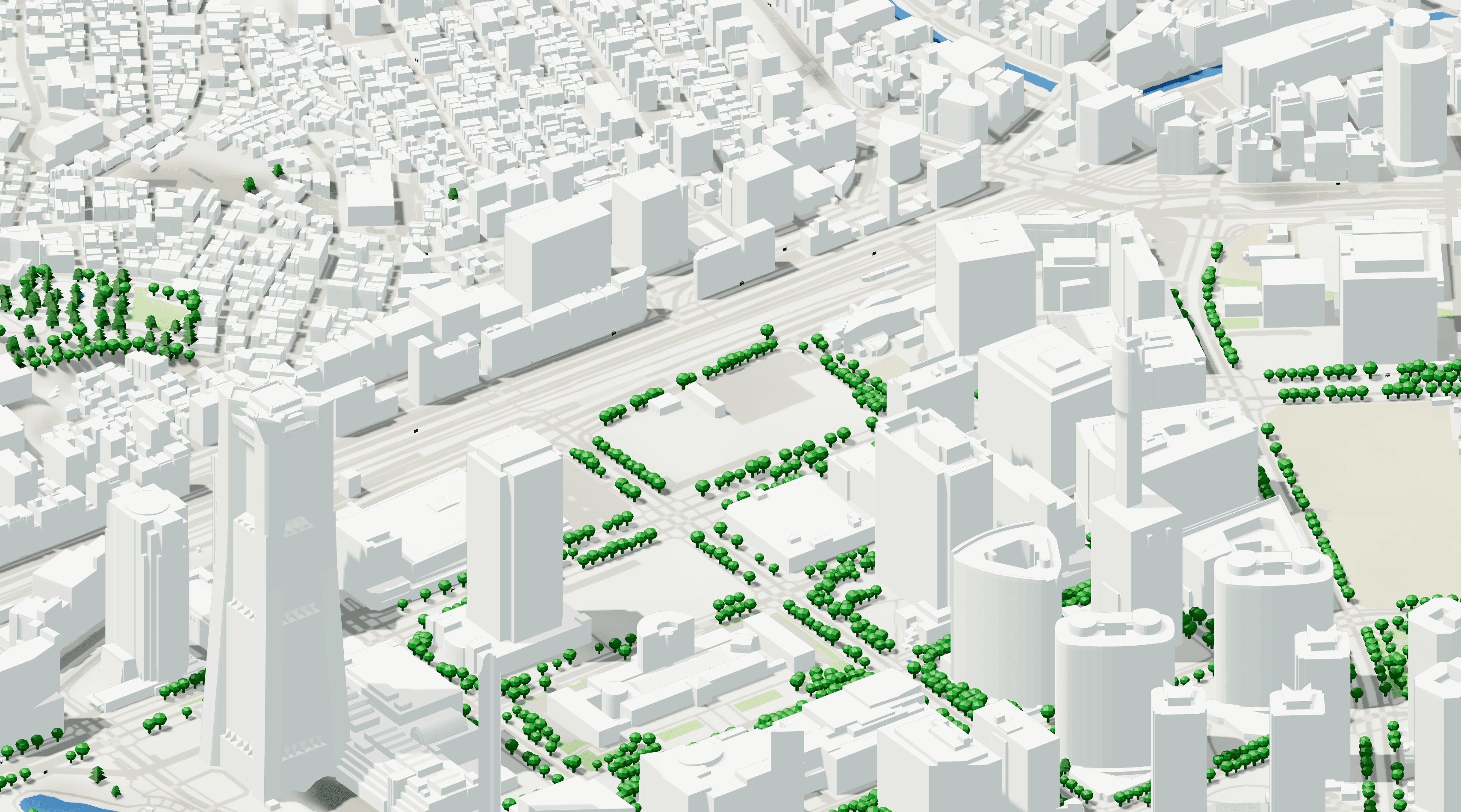
Architects use 3D city models to make decisions about massing, height, daylight, views, and urban fit. Those decisions depend on how complete the city context is.
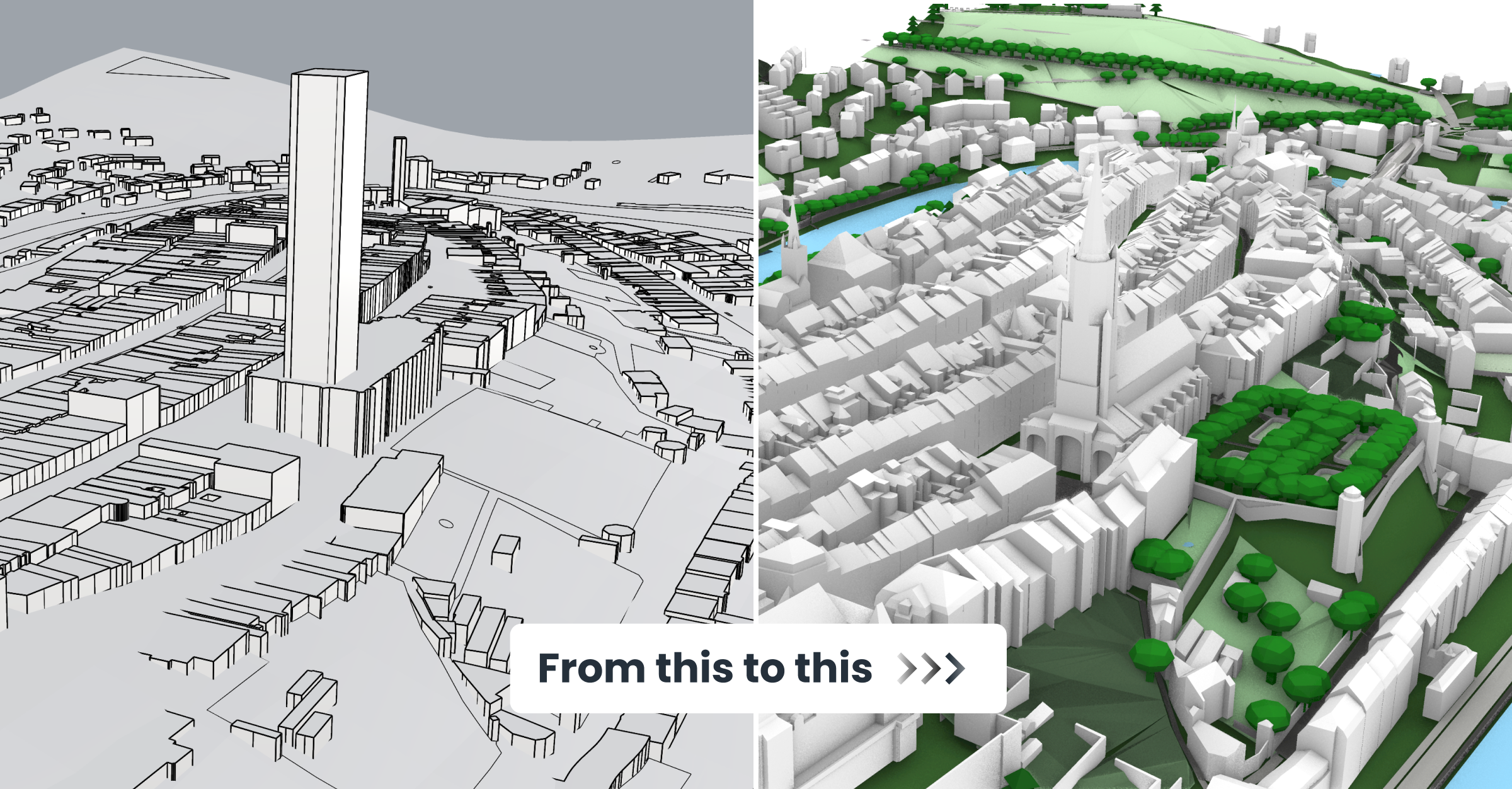
Most architects today work with simplified, globally generated city models.
Cadmapper is one of the most widely used platforms in this category, with around half a million visits each month, and reflects the level of city context commonly used across the industry.
Cityweft operates in the same space but goes further; delivering completed, data-rich city models through deeper processing and the integration of many additional data sources.
A good starting point, but not much more.
OpenStreetMap provides the global backbone of most city models in the AEC industry: building footprints, streets, and urban structure.
Why architects look for an OSM-based 3D model alternative
OSM building footprints are useful, but building heights are often missing or inconsistent
OSM-only workflows usually don’t include terrain/topography
Roof geometry and “hero buildings” are often too simplified for design work
OSM exports can require manual cleanup before they’re usable in Rhino, Revit, or other design software
When used directly, OSM-based models are necessarily simplified.
From ~600M to +3B buildings
With Cityweft you get instant access to:
Over 150 additional datasets from global and national sources - increasing the number of buildings from ~600M from OSM to +3B across the world
Completes building height data using LiDAR datasets and localized information
Generate roof geometry
Integrates high-resolution terrain
Processes everything for consistency and architectural use
The result is a city model where scale, proportion, and topography behave like the real city.
Below we explore a number of comparisons around the world demonstrate the vast difference in city models available on Cityweft compared to classic platforms like Cadmapper.
North America
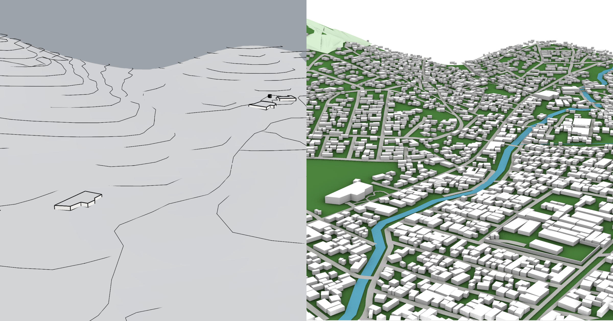
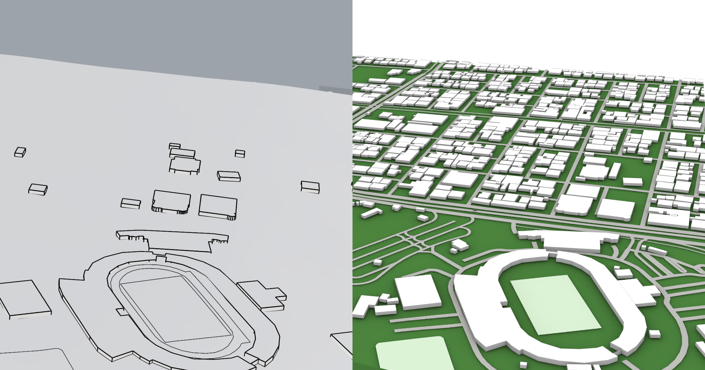
Building heights example: Boston
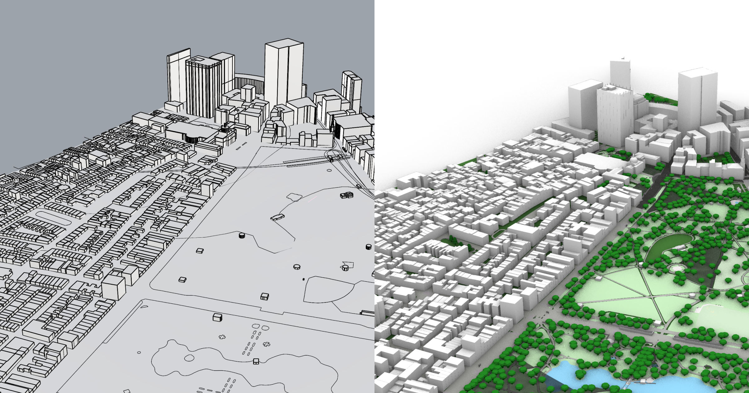
Complete building heights, gathered from from than 4 different sources
Comprehensive surfaces with realistic colors
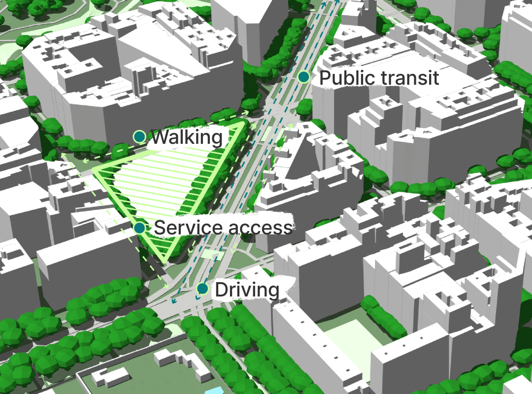
Infrastructure instances including trees, bus stops, benches, and more
Topography Example: San Francisco
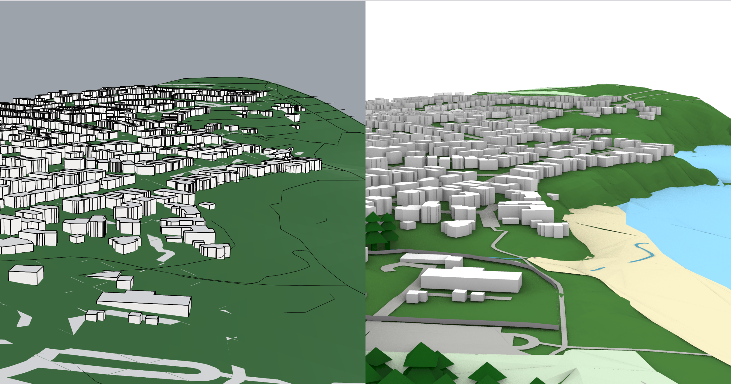
With Cityweft's detailed topography you get realistic models in uneven terrain, like hills or cliffs
In addition, carefully structured surface layers makes for more realistic settings, including sand, water, and barrier geometry
South America
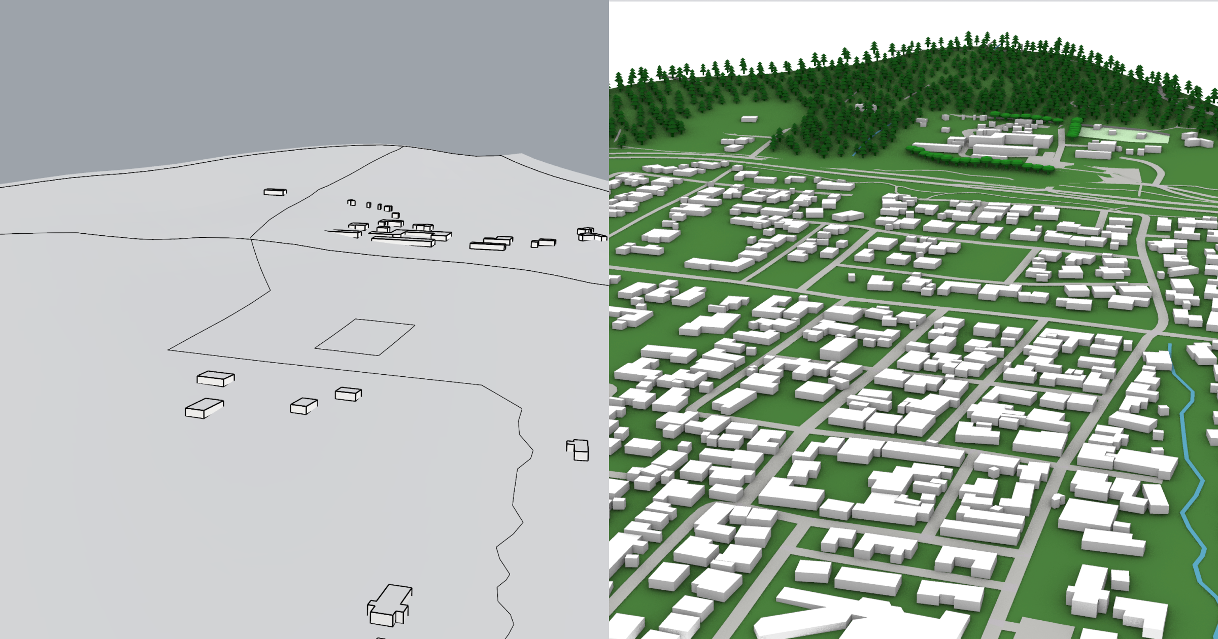
South America is, along with much of the global south, often one of the most underrepresented areas of the world in platforms like OSM. With our additional datasets, powered largely by Google datasets, we provide comprehensive coverage of buildings across the continent across urban and rural areas.
Building coverage example: Mexico City
In areas outside large cities the difference is often the largest - with over 2 Billion additional buildings represented on Cityweft
The biggest differences like this example are commonly found in the global south
Europe
Today, Europe contains some of the most detailed datasets in Cityweft. For buildings alone over 20 datasets are included, ensuring high coverage and precision buildings across much of the continent.
Example: Liverpool, UK
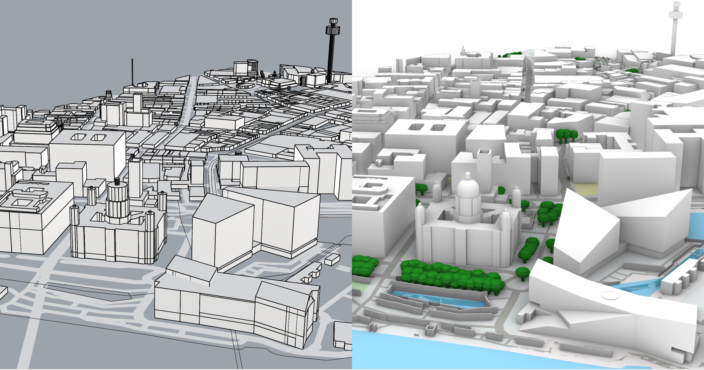
Significantly higher building detail on complex structures, such as churches or unique roof shapes
Accurate, LiDAR-based building heights across the country
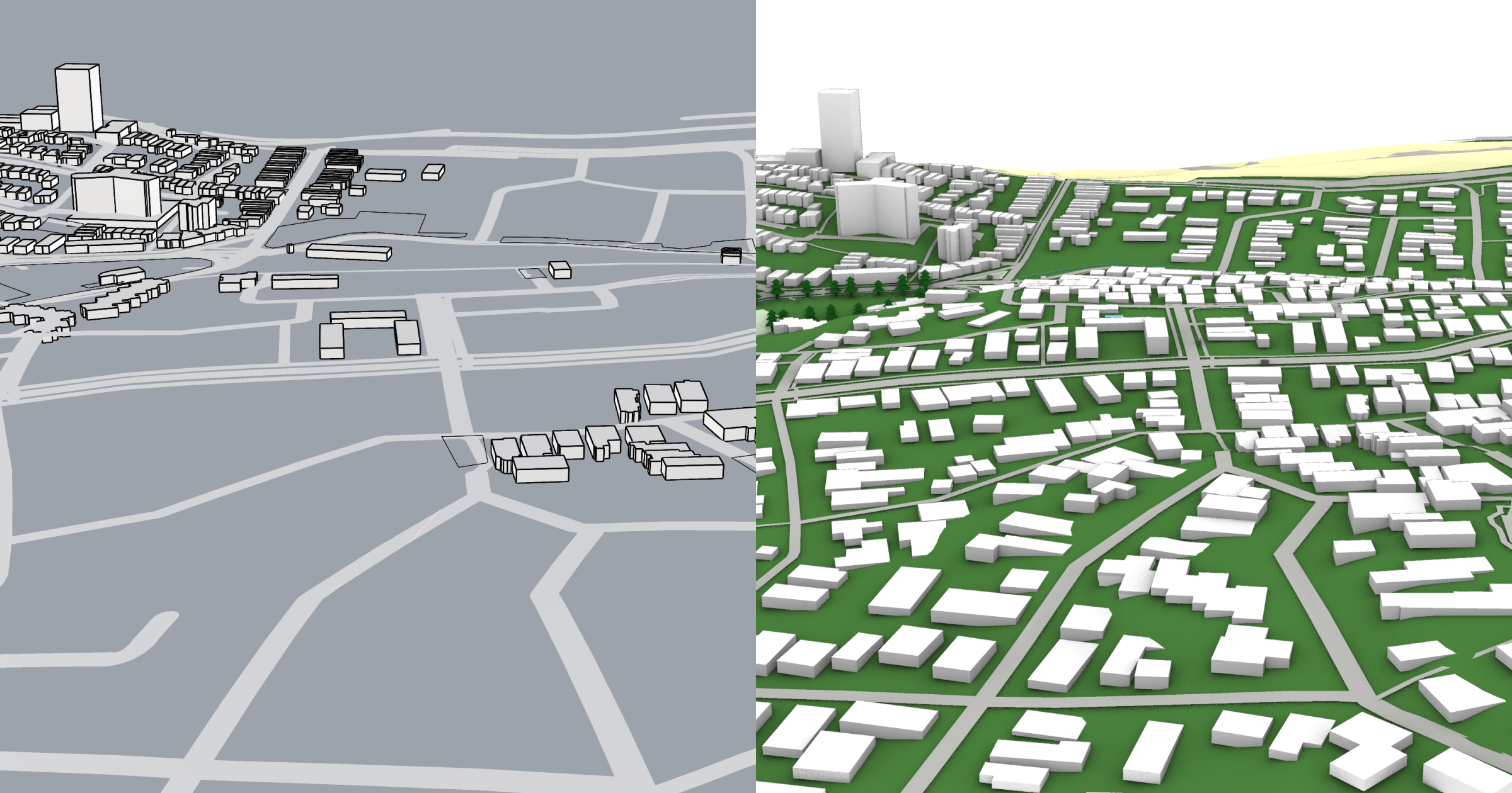
Example: Bern, Switzerland
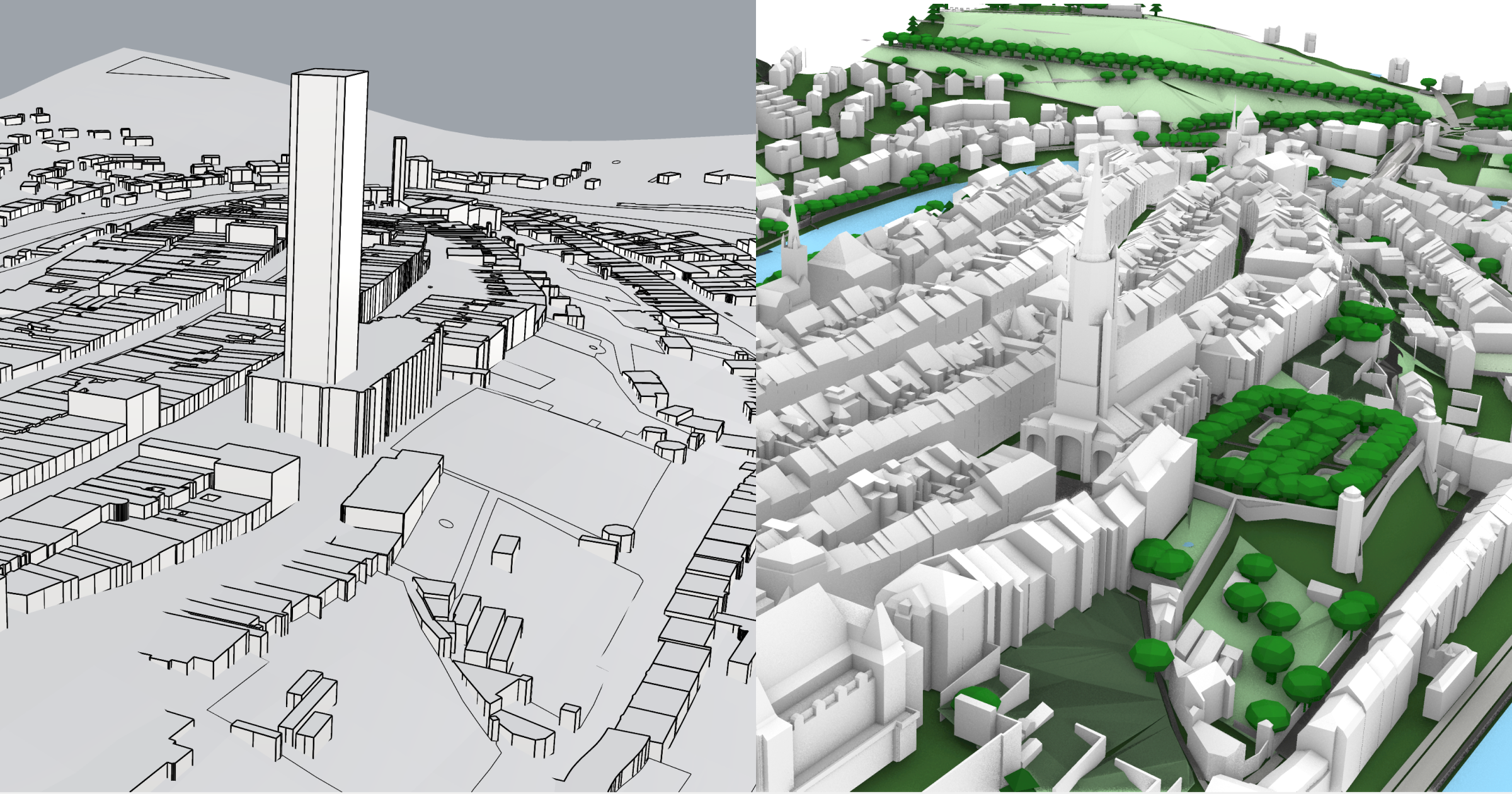
In Switzerland we have integrated the highly detailed LOD2 dataset from SwissTopo
Across the country we provide detailed buildings with intricate geometry details
Africa
Similar to South America, access to building data and topography in the continent remains underserves. Here we again combine multiple datasets to provide best-in-class building coverage and topography.
Example: Cape Town, South Africa
As in the earlier example in Mexico, the additional datasets in Cityweft provide higher coverage of buildings across Africa
Asia
With Asia being one of the most active parts of the world with regards to construction and design, open data remains inaccessible. Here we include datasets including Microsoft and special building datasets for East Asia.
Example: Shanghai, China
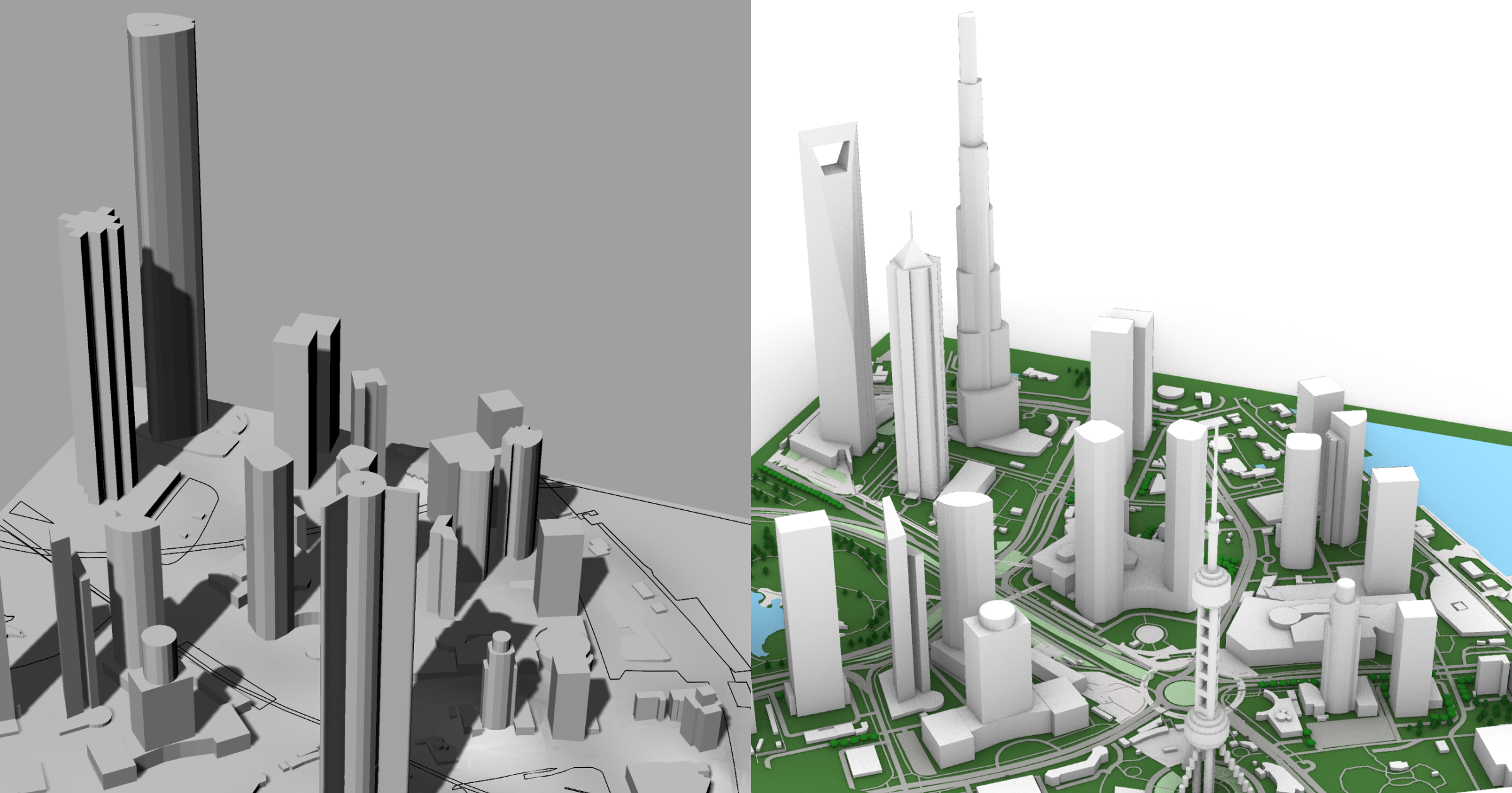
Great architecture deserves great detail; in this example we see Cityweft's detailed building geometry providing a more detailed and realistic cityscape
In addition to the detailed 'hero buildings, you will see the coverage of surrounding buildings is also significantly higher
Example: Riyadh, Saudi Arabia
More buildings, better building height coverage, and more!
Oceania
Finally we reach Oceania, where once again we provide unique data sources to get comprehensive data. While OSM provides good data for the dense metropolitan areas of cities like Sydney, Melbourne, Auckland, and so on - this dissapears rapidly in even suburban areas.
Example: Sydney, Australia
Better building data, precision topography, and more. All you need to design the next Sydney opera house!
One Pattern, Everywhere
What you’ve seen here is only a glimpse of how Cityweft is making it easier than ever to access usable 3D city models around the world.
We still have a long way to go.
Cityweft is building a digital twin of the world—one that goes far beyond static geometry. In 2026, we will make our biggest leap yet, significantly expanding global data coverage, depth, and integrations across the AEC ecosystem.
Our focus is not just on better models, but on building the geospatial data engine for AEC—powering the way architects, planners, engineers, and developers work with real-world context every day.
Cityweft vs OSM-based 3D models (quick comparison)
Input data: OSM-only vs OSM + many additional datasets
Building heights: partial/missing vs completed using LiDAR + localized sources
Terrain: usually missing vs integrated high-resolution topography
Roofs: limited vs generated roof geometry
Architect usability: more cleanup vs consistent, export-ready models
FAQ: OSM-based 3D models and alternatives
What is an OSM-based 3D city model?
It’s a 3D city model generated mainly from OpenStreetMap building footprints and tags like height and levels.
Why are OSM building heights often missing?
Many areas don’t have complete height tagging in OSM, so models can look flat or inconsistent.
What’s the best alternative to OSM 3D models for architecture?
Cityweft is an architect-focused alternative that completes heights, adds terrain, generates roofs, and improves consistency.
Is Cityweft an alternative to Cadmapper?
Cityweft covers a similar early-stage workflow, but with deeper processing and more datasets for richer city context.
Does Cityweft include terrain/topography?
Yes—Cityweft integrates high-resolution terrain so sites behave more like the real city.
Can I export Cityweft models into Rhino / Revit / SketchUp?
Yes—Cityweft supports export workflows for all architectural design tools