Data Update Canada 🇨🇦: New National LiDAR Building Data
Need nationwide LiDAR-based 3D building heights in Canada? Cityweft now includes new national LiDAR building data for Canada, enabling accurate, consistent 3D city context for architecture, planning, and simulation—without relying on incomplete OSM height tags.
Export formats: SKP, OBJ, GLB, 3DM, DXF, GLTF, DAE, PLY, STL.
We’re excited to announce that Cityweft now supports a new nationwide LiDAR-based building height dataset across Canada — bringing accurate, consistent 3D building geometry from coast to coast.
This upgrade delivers two major improvements:
Much more accurate heights in large cities, even where OSM coverage is already strong
Full building height coverage in rural areas, where data gaps have existed until now
The updated Canada dataset is live today across the Cityweft platform, plugins, and API — with no additional setup required.
What’s new
🇨🇦 Nationwide building height coverage
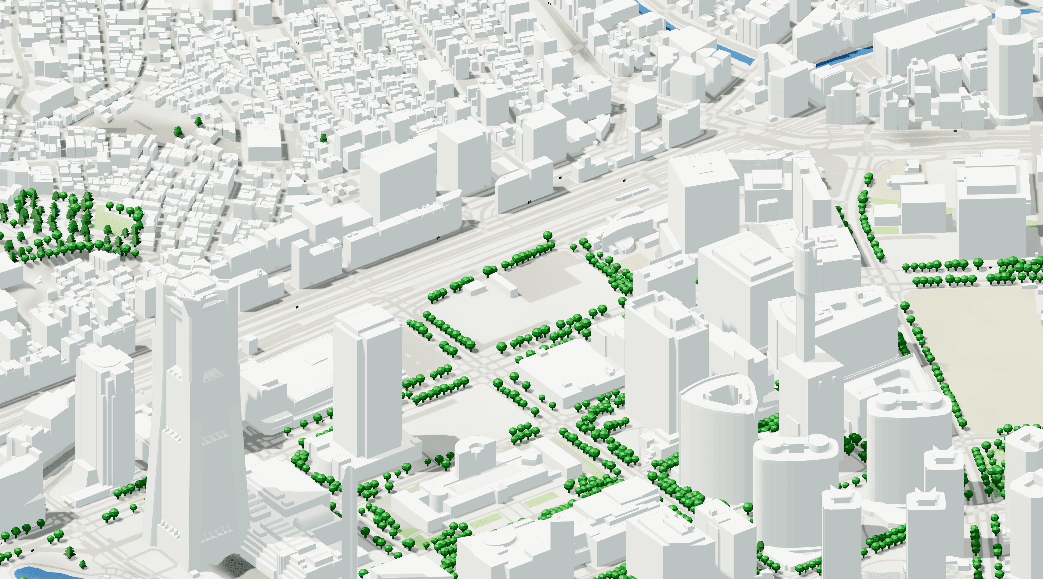
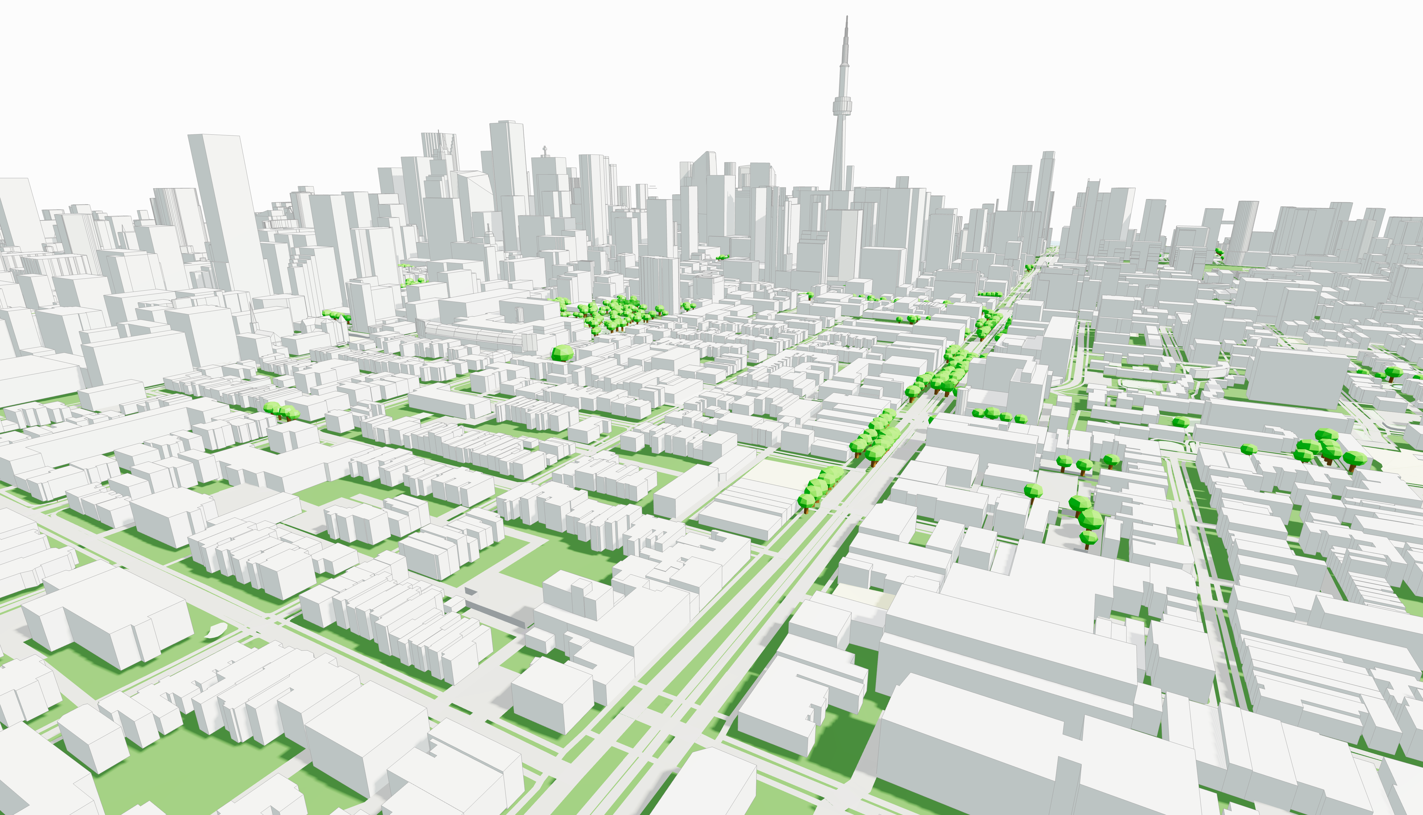
Cityweft now provides Canada-wide building height coverage, generated using high-precision LiDAR-derived elevation data. This ensures reliable building geometry across major cities, coastal regions, and inland municipalities — from Vancouver and Toronto to smaller towns and remote rural areas.
✅ Big cities: corrected heights, higher accuracy
In Canada’s large urban areas, building footprints and attributes are often already well-covered in OpenStreetMap.
However, height values can still be incomplete, inconsistent, or approximate — especially across large areas of dense urban fabric.
Coverage: Canada (national LiDAR building heights)
Nationwide coverage across Canada (urban + rural)
Especially useful for projects in Toronto, Vancouver, Montréal, Calgary, Ottawa, Edmonton, Winnipeg (and more)
With the new LiDAR-based layer, Cityweft now delivers corrected, survey-informed building heights, improving:
skyline accuracy
massing and context realism
reliability for design studies and simulation workflows
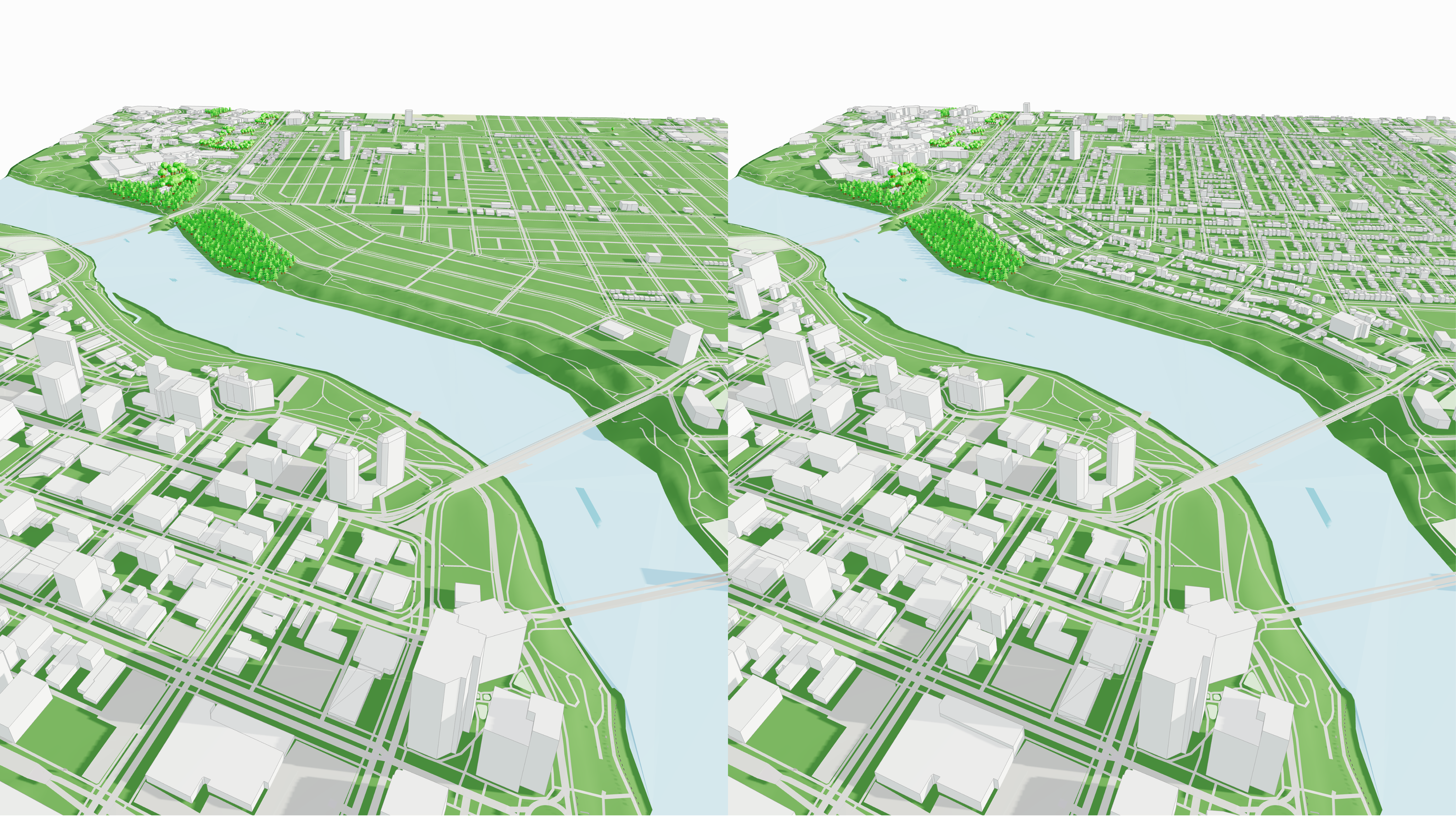
🌲 Rural areas: full coverage where gaps existed before
In rural areas and low-density regions, the challenge has traditionally been different: missing height data altogether.
Cityweft now provides full building height coverage in areas where height attributes were previously sparse or absent, making it easier to work consistently across the entire country — not just the largest cities.
This is especially valuable for:
landscape and environmental studies
infrastructure planning
regional masterplanning
projects outside major metropolitan centres
Why LiDAR building heights improve 3D city context
LiDAR-derived heights create more reliable context than OSM-only workflows, making early design decisions (massing, solar/shadow, views, and fit) more accurate and consistent across different regions.
Built for Canadian workflows
Whether you’re working on early-stage architectural concepts, impact studies, or large-scale planning across Canadian municipalities, Cityweft now provides a stronger, more consistent nationwide baseline — bringing Canada closer to a true high-quality digital twin.
FAQ: Canada LiDAR building heights & 3D building data
What is LiDAR building height data?LiDAR measures elevation directly, enabling more accurate building heights than inferred or manually tagged sources.
Does Cityweft cover all of Canada with LiDAR-derived building heights?Yes — Cityweft provides nationwide coverage of LiDAR-derived building heights across Canada.
Why is this better than OSM-only 3D building heights?OSM can be a good baseline, but building height tags are often incomplete or inconsistent depending on the area. LiDAR-derived heights provide more reliable coverage.
What can I use Canada 3D building heights for?Architectural site context modelling, massing and feasibility studies, shadow and solar analysis, visibility studies, planning workflows, and simulations.
How do I access the Canada dataset in Cityweft?It’s available through the Cityweft web platform, plugins, and API.
What export formats does Cityweft support?Cityweft supports SKP, OBJ, GLB, 3DM, DXF, GLTF, DAE, PLY, and STL exports.