Germany Nationwide LOD2 Building Data | Cityweft 🇩🇪
Need 3D building data in Germany (LOD2)? Cityweft now includes nationwide German 3D building models from official state geospatial authorities. You can generate design-ready 3D city context for Germany — including accurate roof geometry and building heights — in minutes using the Cityweft web platform, Rhino plugin, or API. 🇩🇪
Export your models directly into your preferred workflow.
Export formats: SKP, IFC, OBJ, GLB, 3DM, DXF, GLTF, DAE, PLY, STL.
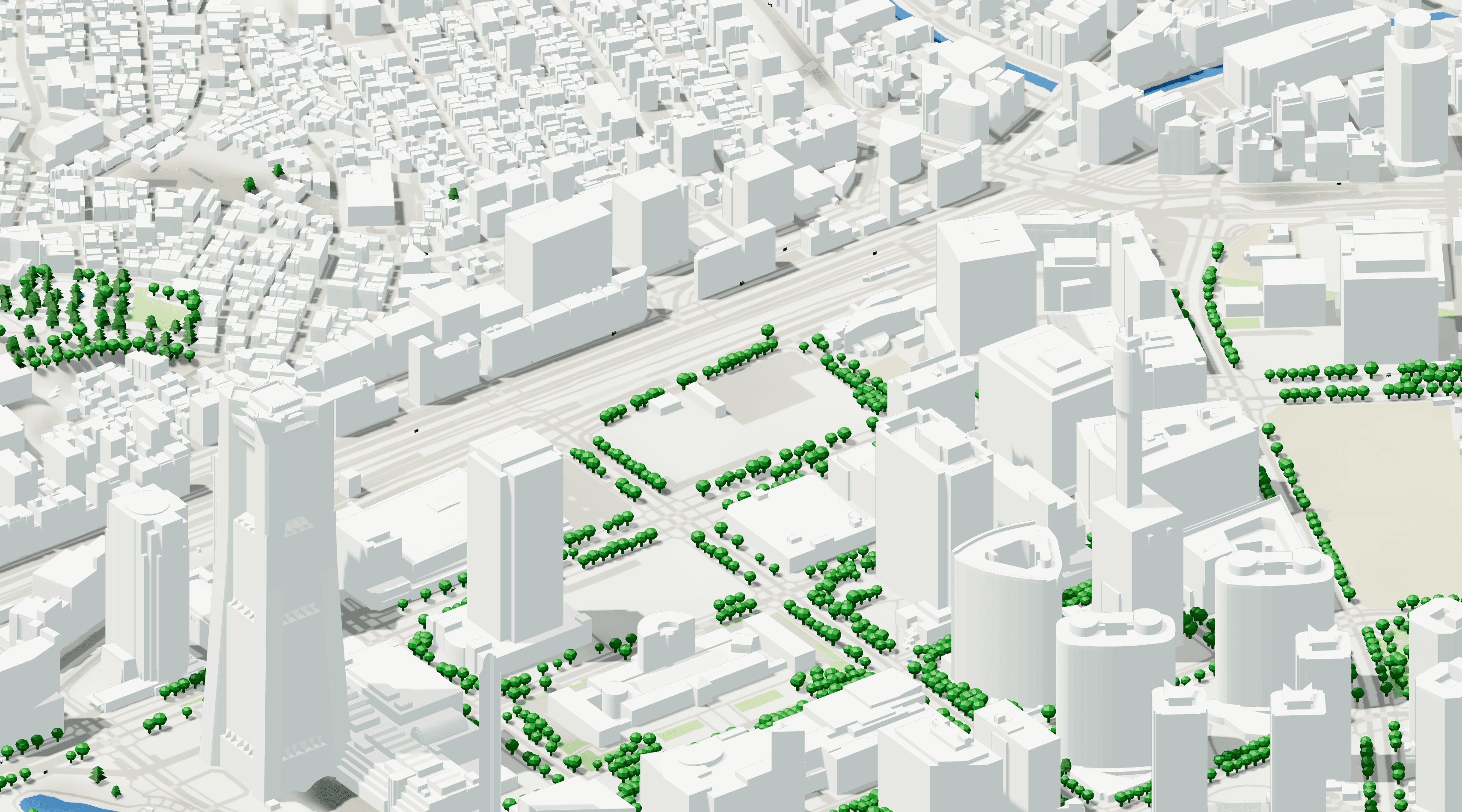
We’re excited to announce that Cityweft now supports nationwide 3D building coverage across Germany using official LOD2 datasets from the German state surveying authorities.
These datasets follow the standard German LoD2 building model specification, significantly improving the accuracy and realism of city models across Germany generated with Cityweft.
What’s new
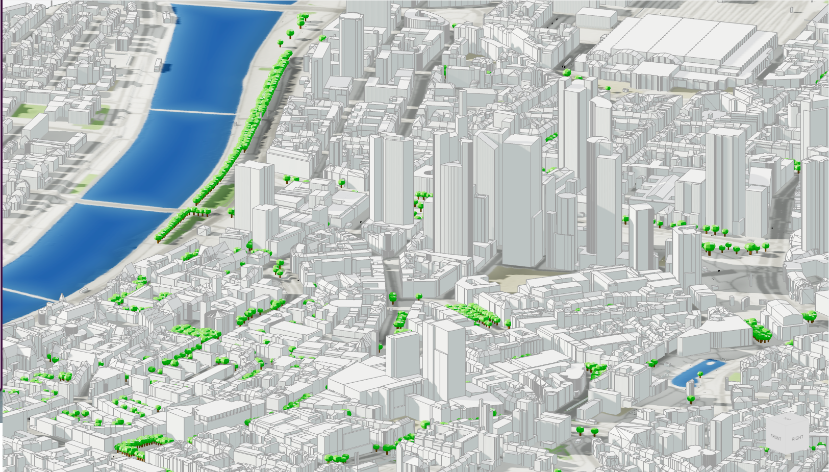
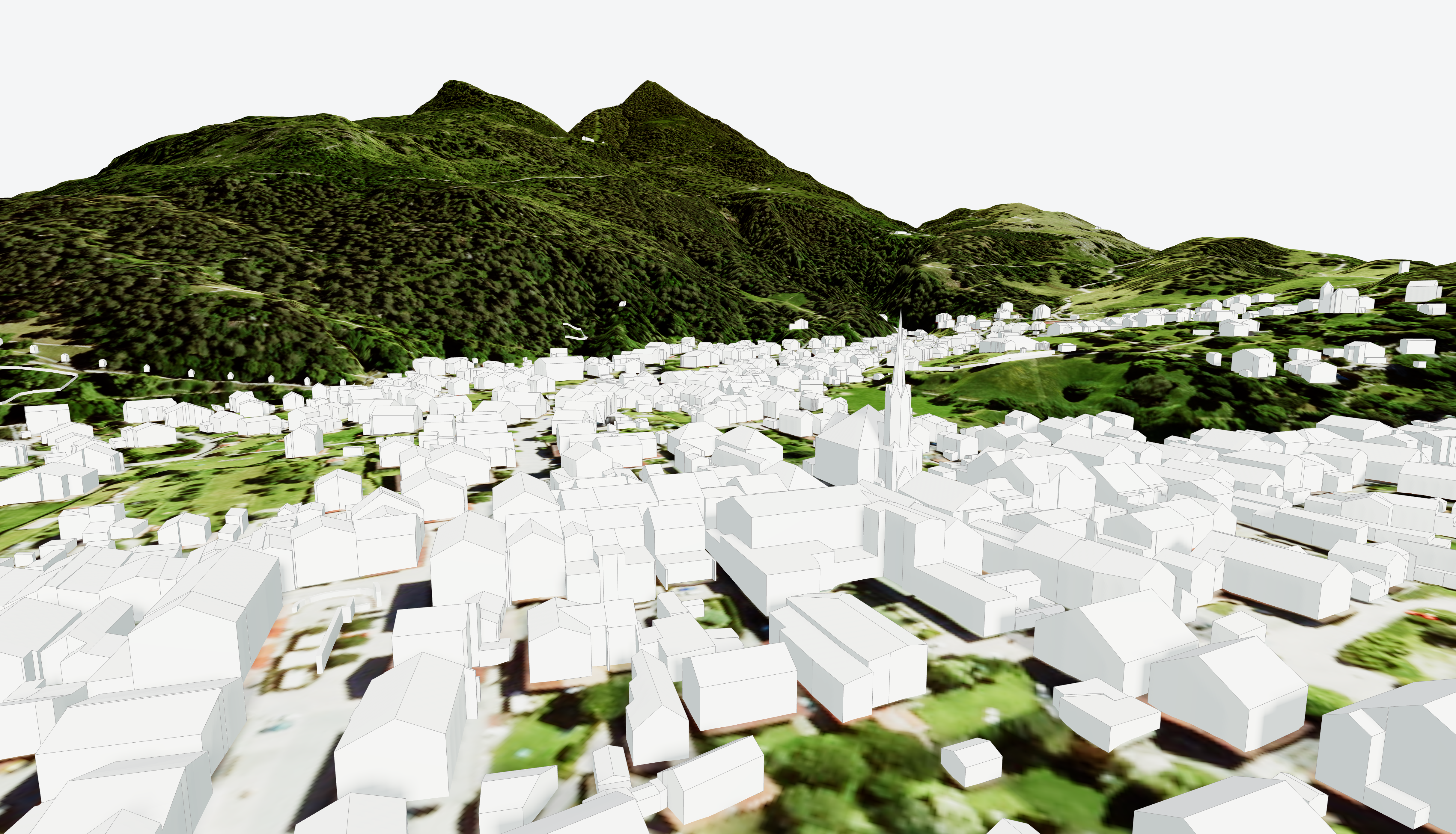
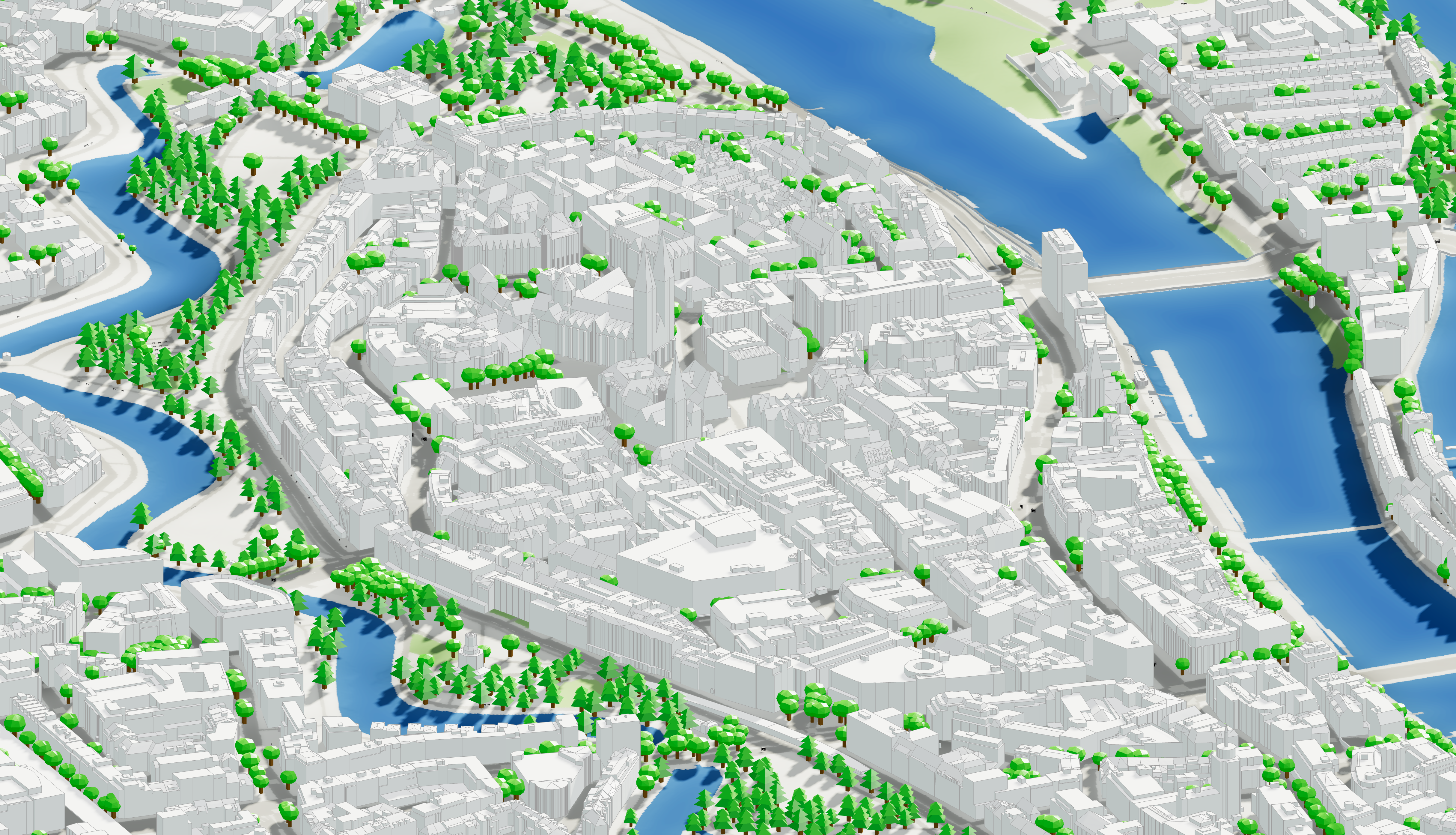
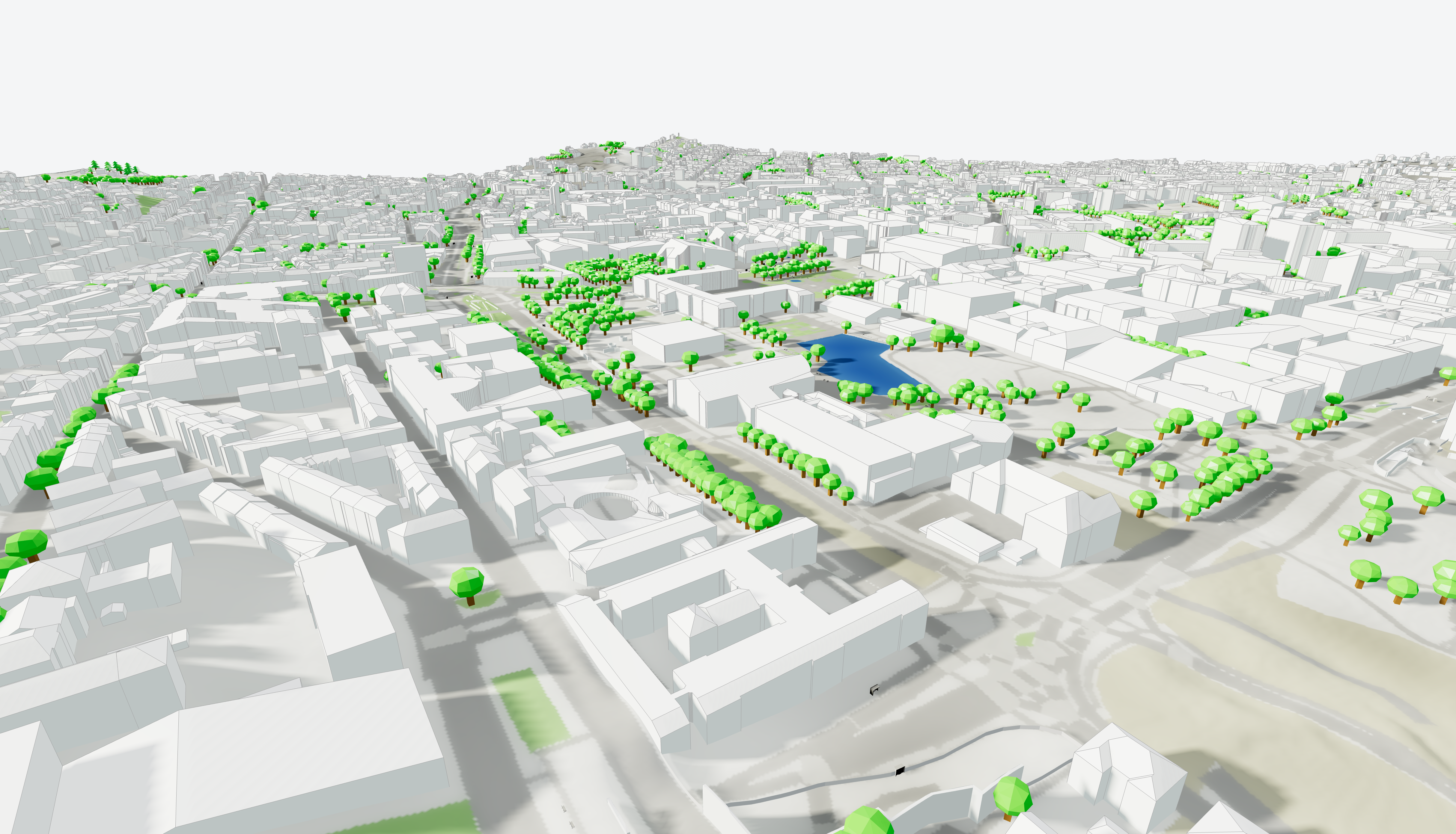
National 3D building coverage (LOD2)
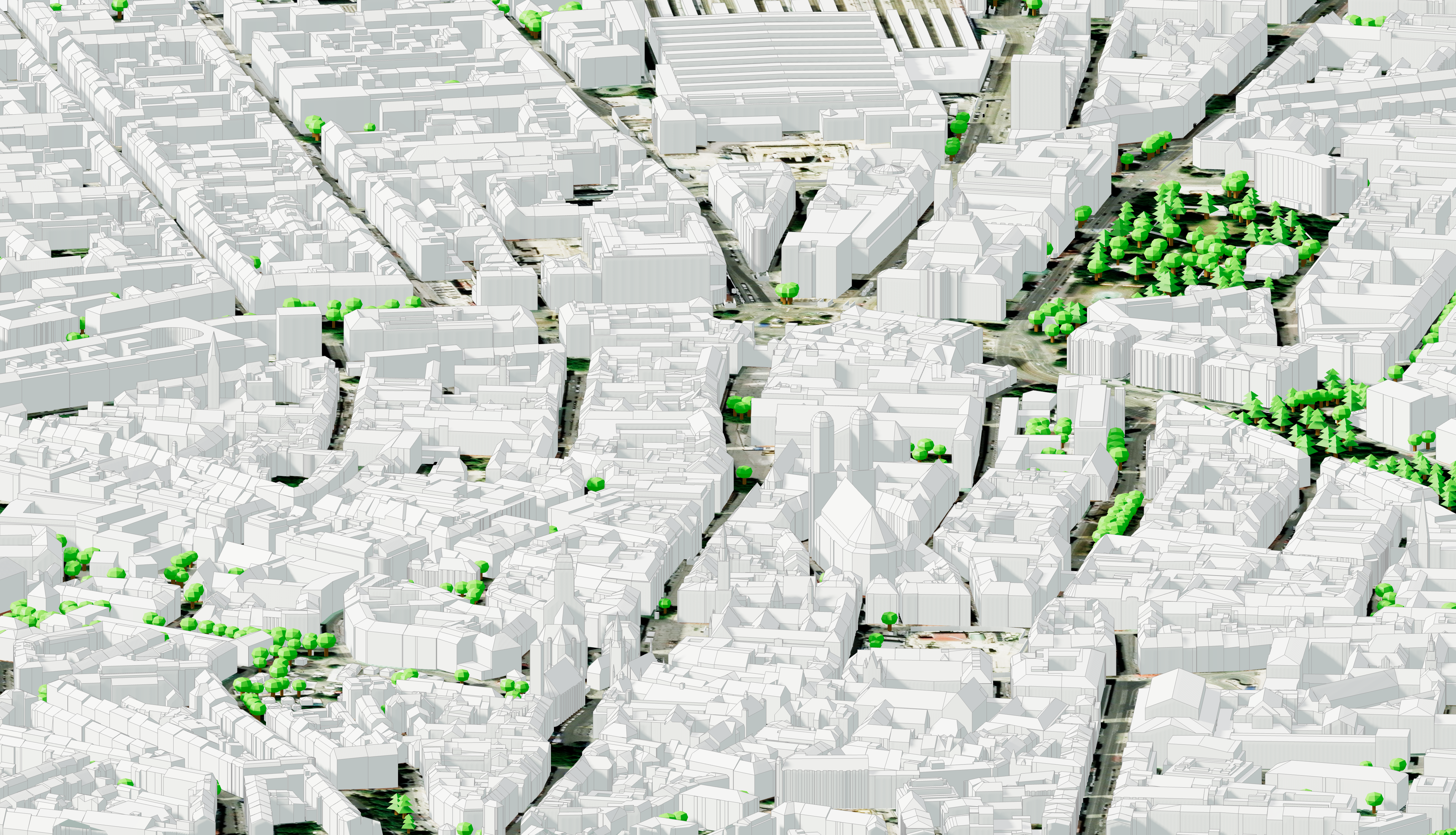
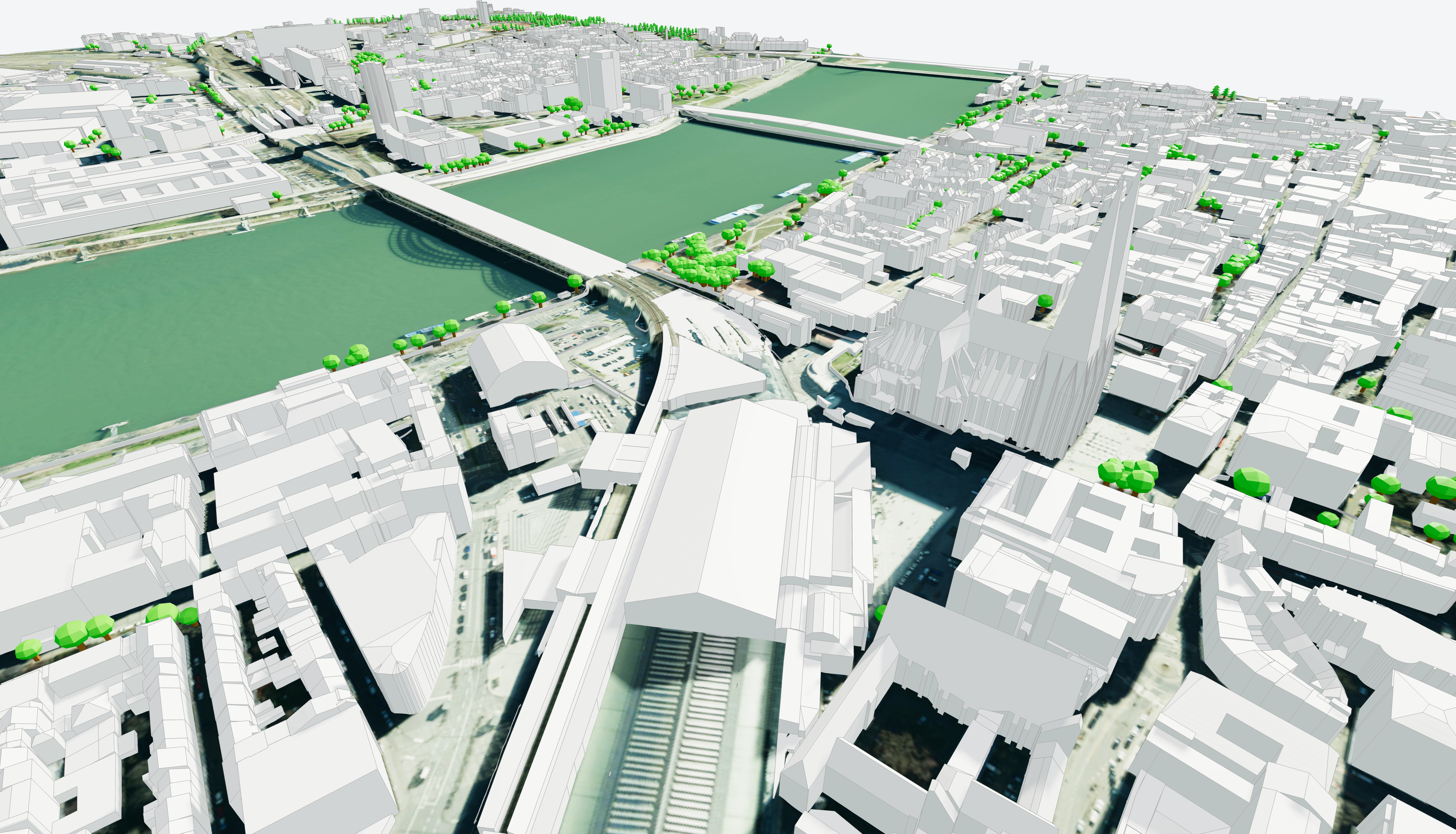
Cityweft now includes detailed LOD2 building models across Germany, combining datasets from 15 German federal states.
Each building includes:
accurate roof geometry
reliable building heights
detailed building footprints
This allows you to generate high-quality urban context models anywhere in Germany.
Higher-fidelity urban context
Compared with simple building extrusions, the LOD2 dataset provides:
realistic roof shapes
improved building height accuracy
more detailed urban massing
This makes the dataset ideal for:
architectural design
planning studies
energy and solar analysis
visualization
digital twin models
Available across all Cityweft workflows
The Germany building dataset is available across the full Cityweft ecosystem:
Cityweft web platform
Plugins
Cityweft API
This means you can integrate the dataset directly into your existing design workflow.
Coverage: Germany (nationwide LOD2 building dataset)
Cityweft integrates official datasets from 15 German state geospatial authorities, providing near-nationwide building coverage.
The included datasets come from:
Bavaria — Bayerische Vermessungsverwaltung (LDBV)
Lower Saxony — LGLN Niedersachsen
Baden-Württemberg — LGL Baden-Württemberg
Bremen — GeoInformation Bremen
Saxony-Anhalt — LVermGeo Sachsen-Anhalt
Saxony — GeoSN Sachsen
Berlin — Senatsverwaltung für Stadtentwicklung
Mecklenburg-Vorpommern — LAiV Mecklenburg-Vorpommern
Hamburg — LGV Hamburg
Schleswig-Holstein — LVermGeo Schleswig-Holstein
North Rhine-Westphalia — Geobasis NRW (OpenGeodata.NRW)
Brandenburg — LGB Brandenburg
Thuringia — TLVermGeo Thüringen
Hesse — HVBG Hessen
Rhineland-Palatinate — LVermGeo Rheinland-Pfalz
These organizations are the official cadastral and geospatial authorities responsible for Germany’s national mapping data.
Coverage across all major German cities
The dataset supports projects in:
Berlin
Hamburg
Munich
Cologne
Frankfurt
Stuttgart
Düsseldorf
Leipzig
Dresden
and everywhere else in Germany.
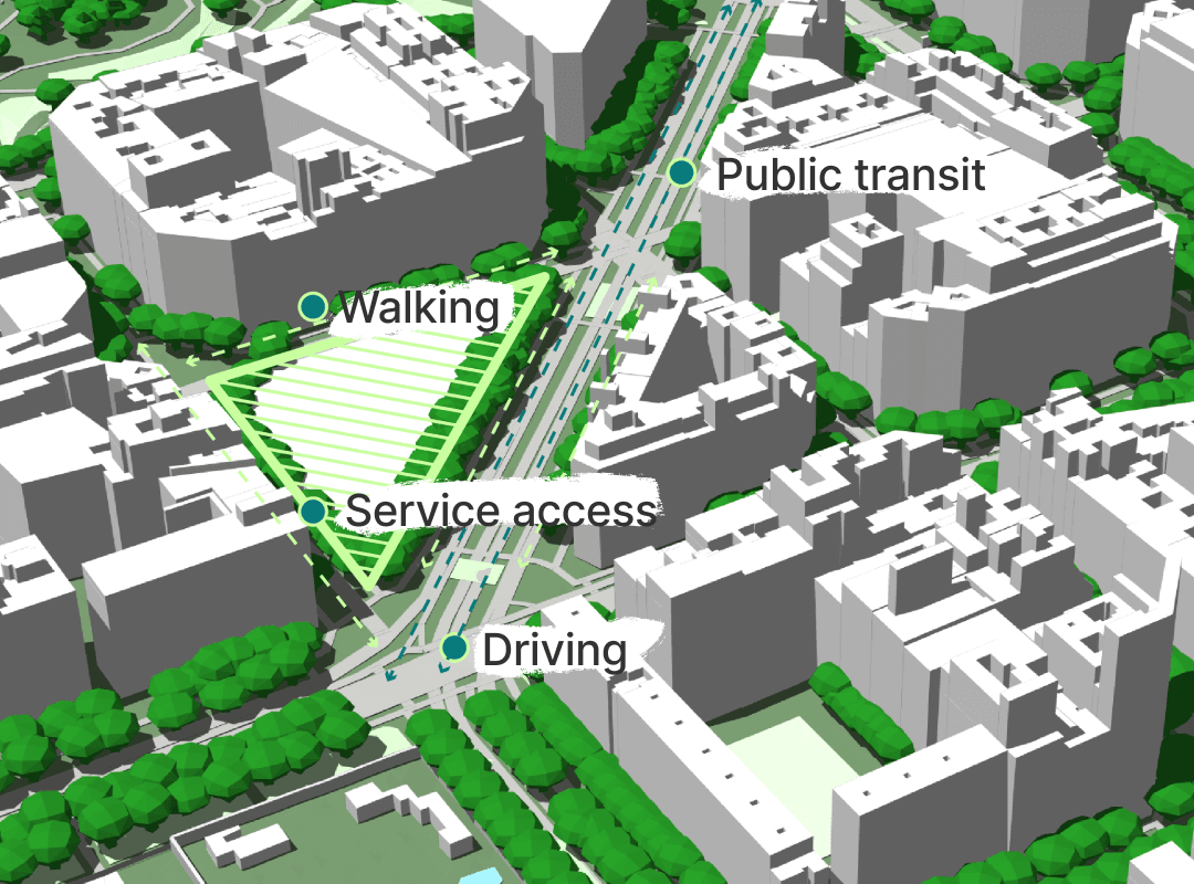
Why this matters
For architects, planners, engineers, and developers working in Germany, the LOD2 dataset unlocks a major improvement in site context modeling.
You now get:
Authoritative government data
All buildings originate from official German surveying authorities, ensuring high reliability.
More realistic design context
Accurate roofs and building heights improve:
concept design
competition models
feasibility studies
stakeholder visualizations
Better analytical accuracy
LOD2 buildings improve simulations for:
shadow analysis
solar potential
line-of-sight
urban density
environmental simulations
A smooth workflow
Access the data through:
the Cityweft platform
Cityweft plugins
the Cityweft API
and export it directly to your modeling software.
Open data licensing
Most German states publish their 3D building models as open geodata under the “Datenlizenz Deutschland” license framework.
Two licenses apply across the datasets.
Datenlizenz Deutschland – Namensnennung 2.0 (DL-DE BY)
This license allows:
commercial use
modification
redistribution
integration into software platforms
The only requirement is proper attribution to the original data provider.
Most German state datasets use this license.
Datenlizenz Deutschland – Zero 2.0 (DL-DE Zero)
Some datasets are released under DL-DE Zero, which allows unrestricted reuse without attribution requirements.
Within the Cityweft dataset this applies to:
Berlin
North Rhine-Westphalia
How the data is prepared in Cityweft
Germany’s geospatial data is managed by individual federal states, meaning datasets vary in:
format
structure
modeling practices
update cycles
Cityweft harmonizes these datasets using a standardized processing pipeline that:
aggregates data into a single national dataset
cleans and validates geometry
optimizes buildings for fast loading in 3D
ensures consistent coordinate systems
maintains attribution to the original authorities
The result is a clean, unified LOD2 building dataset for Germany ready for immediate use in design workflows.
Who this is for
Architects: Competitions, early massing, site context, and client visuals.
Urban planners: Visibility studies, density scenarios, and planning proposals.
Engineers: Solar analysis, shadow studies, and simulation context.
Real estate developers: Feasibility studies and stakeholder communication.
FAQ: Germany 3D building data (LOD2)
What is LOD2 building data?
LOD2 (Level of Detail 2) is a standardized 3D building model that includes roof geometry and accurate building heights, making it more realistic than simple extruded buildings.
Does Cityweft cover all of Germany?
Cityweft integrates 15 official LOD2 datasets from German state authorities, providing near-complete national coverage.
What can I use this data for?
Typical uses include:
architectural context modeling
urban design studies
solar and shadow analysis
visualization and rendering
digital twins and planning simulations
How do I access the dataset?
You can access the Germany building dataset through:
the Cityweft platform
the Rhino plugin
the Cityweft API
What export formats are supported?
Cityweft supports the following export formats:
SKP, IFC, OBJ, GLB, 3DM, DXF, GLTF, DAE, PLY, STL